
![]() |
Paul Deckret
|
Paul Deckret
Shio no Michi: Walking Japan's Ancient Salt Road

While Japan’s Nakasendo and Kumano Kodo receive a lot of well-deserved attention as the country’s two most celebrated walking routes, you may be surprised to hear that there is another major yet relatively-unknown historic trail located right here in central Japan: the Shio no Michi. Despite being a beautiful and fascinating route on par with the Nakasendo and Kumano Kodo in terms of historical and cultural significance, a lack of information and infrastructure have kept it from achieving the same level of notoriety. Although it might not be ready for its mainstream debut, it is a hidden gem waiting to be discovered by intrepid travelers.
Table of Contents
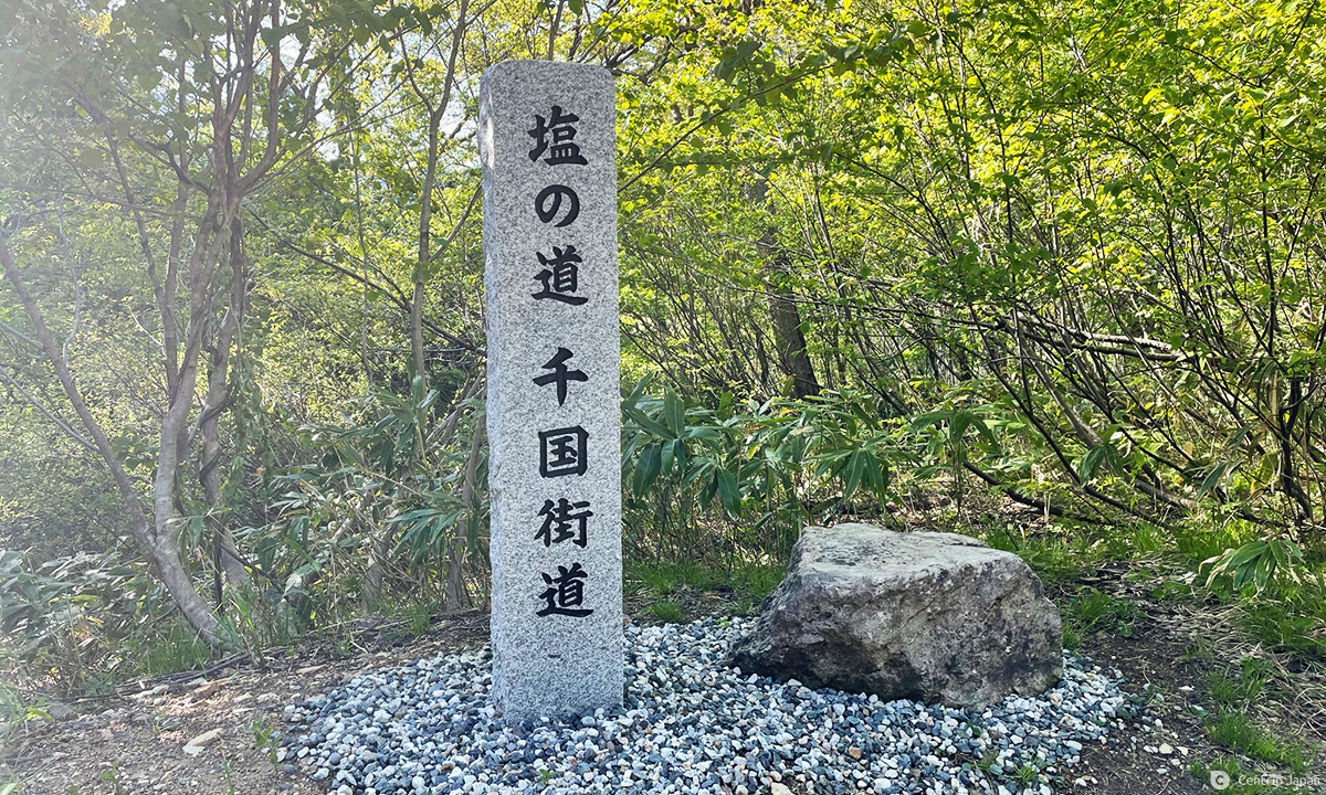
Japan’s Most Important Salt Road
Shio no Michi translates to “salt road;” a generic term that describes any route that was once used for the transportation and trade of the vital mineral. Since Japan was entirely dependent on the sea for salt production, salt roads were used to distribute it to the interior areas of the country. And while a number of such trails once existed across the country, one is recognized as the most historically important and best-preserved route today. That salt road, the Salt Road, is called Chikuni Kaido but is most often referred to as simply - Shio no Michi.
A Brief History of the Chikuni Kaido
The Chikuni Kaido was the principal highway used to haul salt, marine products, hemp, tobacco and more between the provinces of Echigo (Niigata) and Shinshu (Nagano) for hundreds of years. The route ran for more than 120km from present-day Itoigawa on the Sea of Japan to the landlocked ancient castle town of Matsumoto. In existence since at least the Middle Ages, it reached its zenith during the late 1700s during which time pack animals and human porters known as “bokka” ferried a continuous supply of goods along the trail year round.
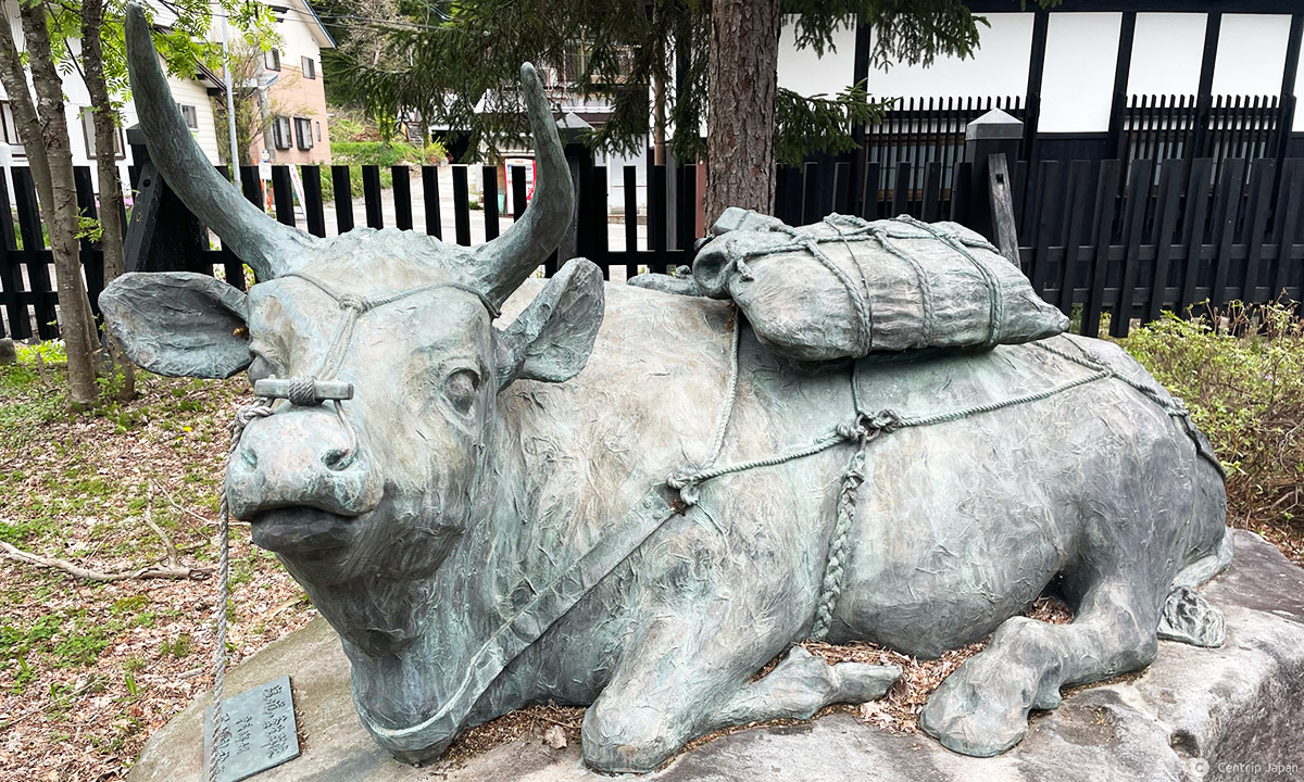
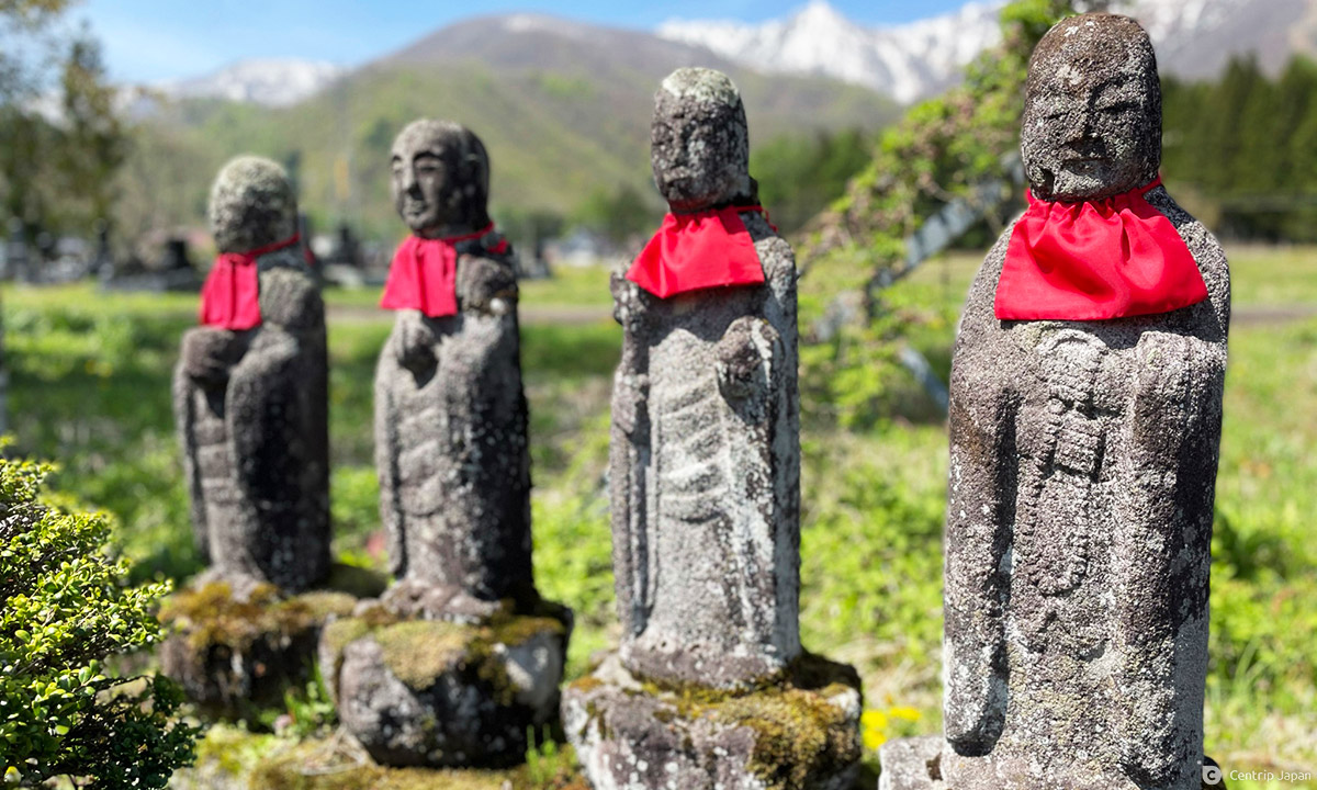
These “bokka” carried between 45 to 60kg in their wooden-framed packs with braided-straw shoulder straps, up and over arduous mountain passes fraught with risk and perils. Many died of exposure, falls and exhaustion. In fact, thousands of centuries old stone statues and markers flank the trail; many of them paying tribute to men, women and animals that didn’t survive the journey. Winter posed the greatest challenge, since the route cuts straight through the heart of Japan’s heavy snow country - where the mountainous sections would have been blanketed in up to 5m of snow for a good portion of the year. During the snow months, oxen and horses were unable to pass, so all that was carried was done so on the backs of porters equipped with wooden snowshoes.
Ultimately, rapid road and railway construction during the early part of the Meiji Era (late 19th century) led to the once-vibrant Chikuni Kaido quickly falling out of use. For nearly 100 years it lay silent and forgotten alongside the roads that replaced it, under the thick cover of weeds and fallen trees of the forests and mountains that still held the memories and lingering evidence of its former glory. Finally, a book published by a researcher in 1976 reintroduced the route to a modern audience, igniting interest and spurring restorative efforts. Historical texts and the ubiquitous statues, shrines, temples and other physical remnants marked the way and helped guide the restoration.

Walking the Chikuni Kaido
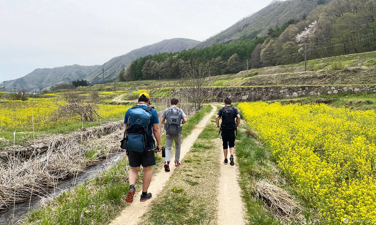
Today it is possible to cover the Chikuni Kaido from start to finish on a combination of paved roads and quiet paths that follow or closely parallel the original route. It’s an epic journey that presents plentiful opportunities to enjoy gorgeous scenery, capture memorable photos, interact with locals, observe deeply-held customs and traditions, encounter wildlife, soak in hot springs, sample regional foods and see a side of Japan that many never do.

While the Shio no Michi is a continuous long-distance route recognized by the Japan Long Trail Association and could be covered in a single, multi-day push, it is more easily done in segments due to transportation, lodging, resupply and other practical reasons. The route is doable independently, but it’s hard to find good maps and information in English, and even the available Japanese information is more suited to providing a general overview of the course than it is to successfully navigating it. Alternatively, a number of companies are now running or planning guided tours on the Shio no Michi and employing their services or those of a local guide who knows the area would do a lot to ease the logistical headaches. As a bonus, a good guide should be able to fill you in on the important details and captivating stories that provide perspective and set the Shio no Michi apart from other trails.
In general the best seasons to visit are spring (April to June) and autumn (September to November), but the southern end of the route (Omachi to Matsumoto) can be walked most of the year, while the northern end, specifically Itoigawa to Hakuba, receives heavy snowfall and is impassable during the winter months. The highest point of the route (Oami Pass) is typically covered in snow from early December to late May.
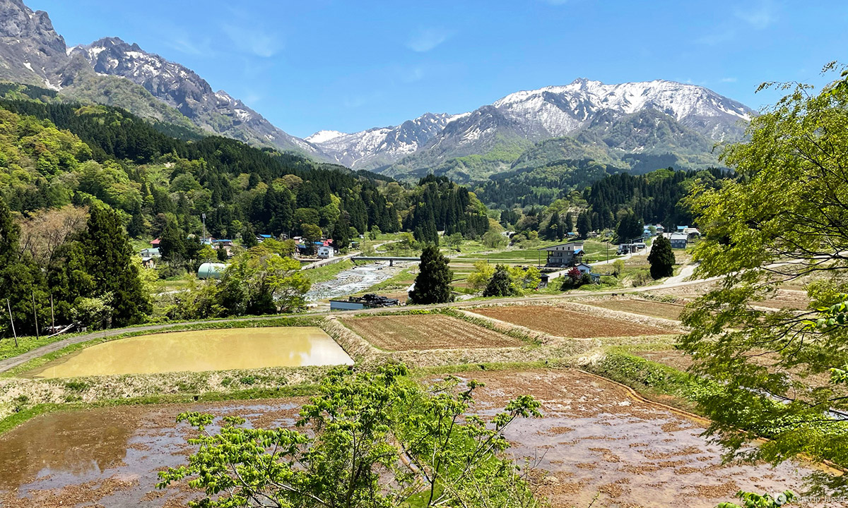
The trail can be roughly divided into three major sections, each with their own unique landscapes, characteristics and appeal: the Mountain Area (Itoigawa & Otari), the Satoyama Area (Hakuba, Omachi & Ikeda) and the Urban Area (Azumino & Matsumoto).
The Chikuni Kaido by Region
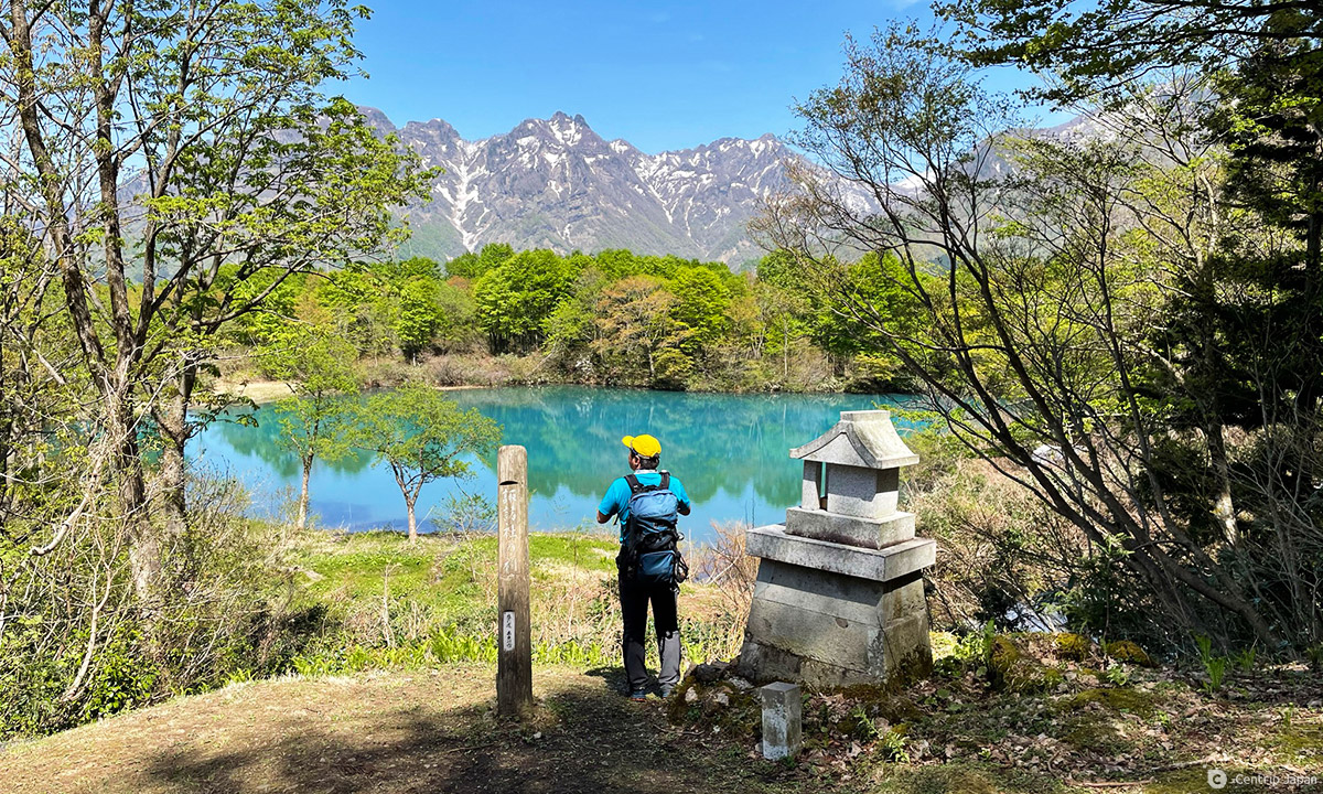
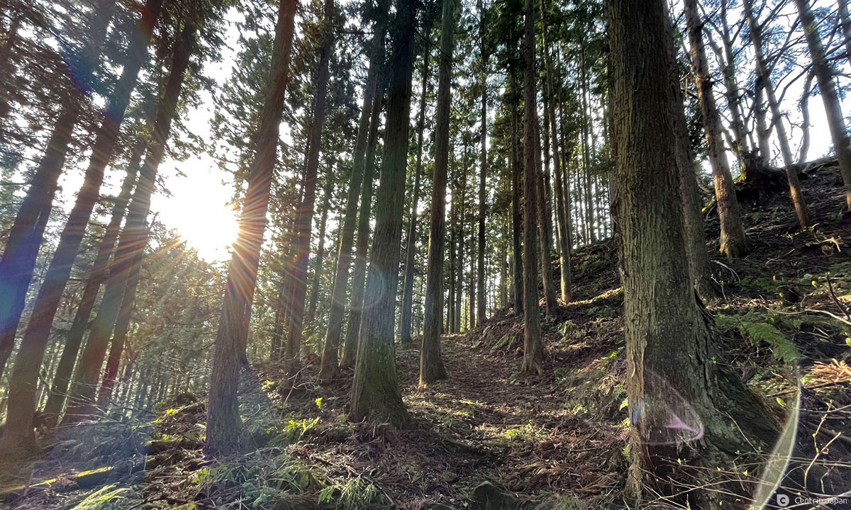
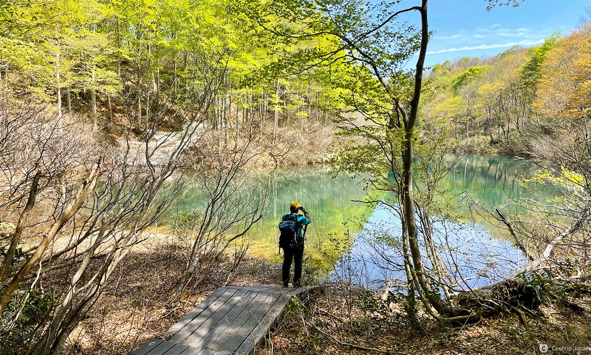
ITOIGAWA: The route jumps back and forth between asphalt and gravel roads broken up by short sections of trail in Itoigawa, steadily climbing higher past wide expanses of rice fields before finally settling into a long section of forested dirt trail just beyond the small but worthwhile Salt Trail Museum. You pass the stunning Shiroike pond immediately before crossing over into Nagano Prefecture via Otari’s beautiful and rugged Oami Mountain Pass (Oami Toge).
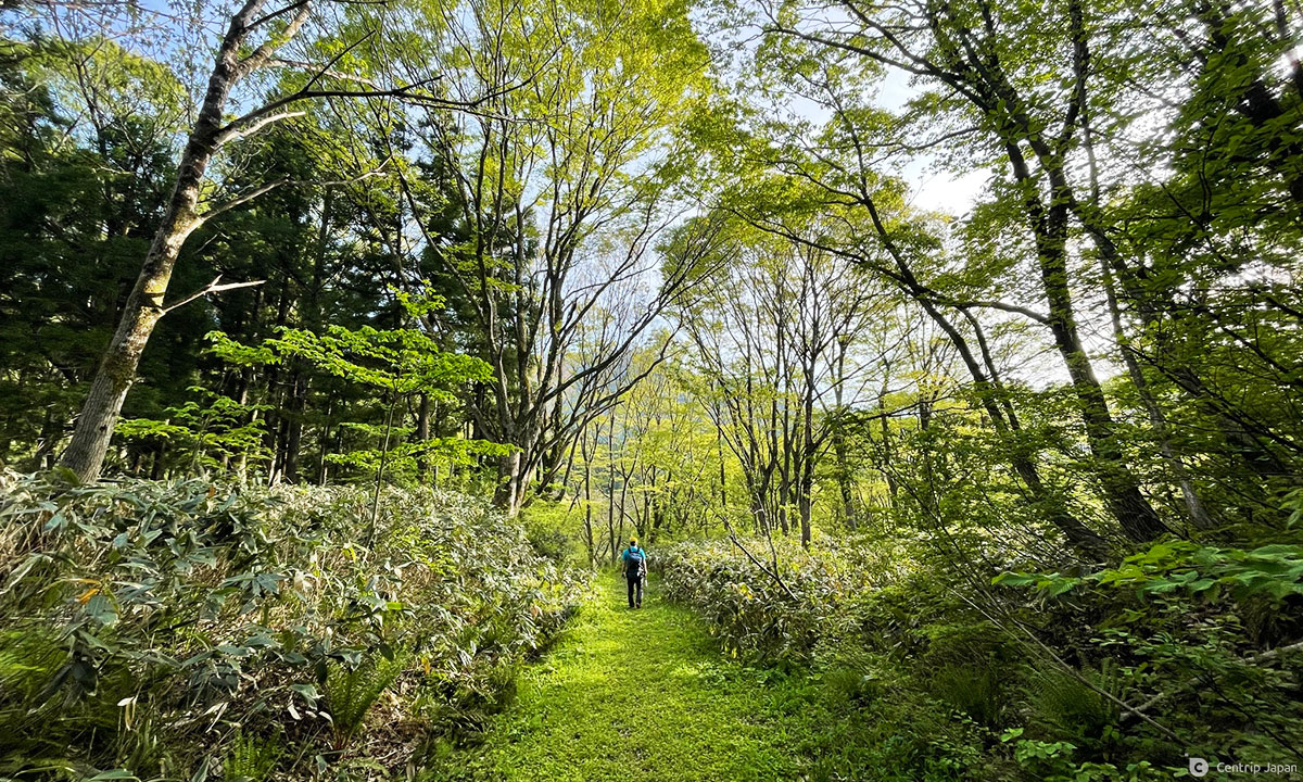
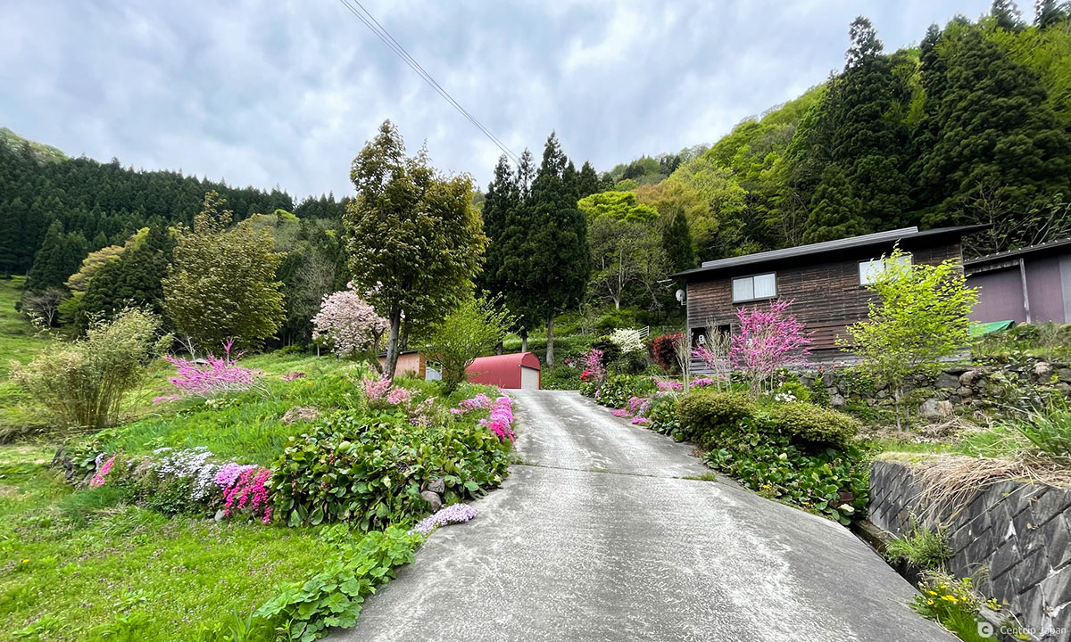
OTARI: The best-preserved and most scenic nature sections are located in the rural village of Otari, with the aforementioned Oami Pass’ deep v-shaped trail cutting through the heart of a gorgeous beech forest being the highlight of the area and possibly the whole Chikuni Kaido. The Shio no Michi here perfectly showcases Otari’s “satoyama” landscape by artfully weaving in and out of forested mountain paths and idyllic countryside hamlets. This portion of the Shio no Michi makes you feel as if you’ve stepped back in time.
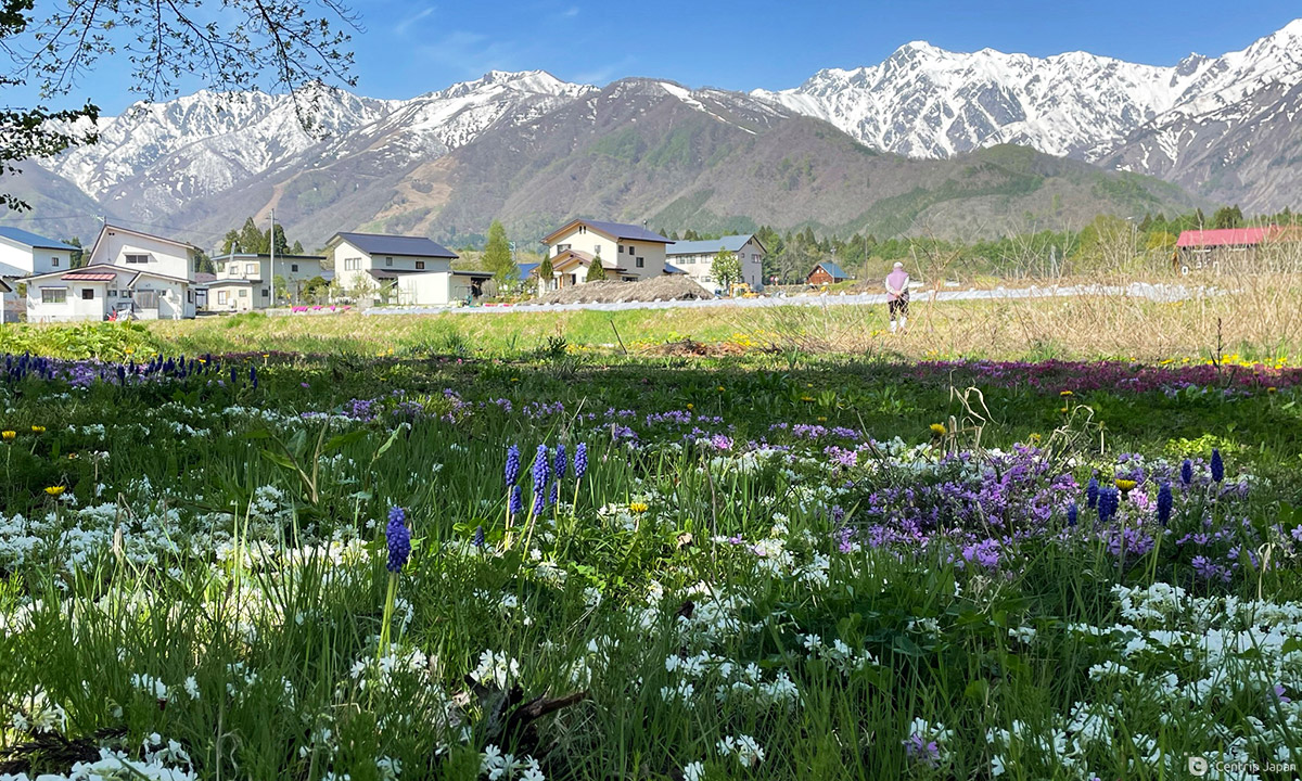
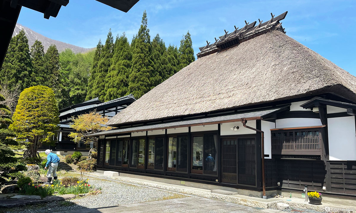
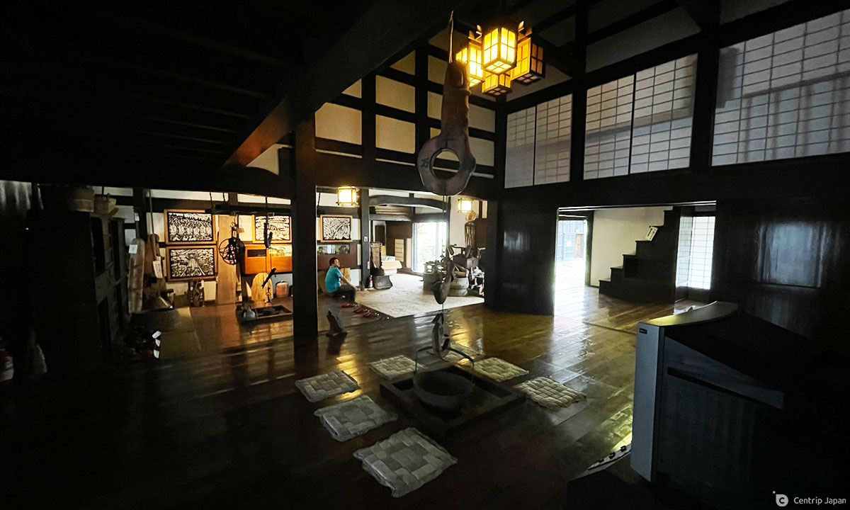
HAKUBA: Just before entering Hakuba you’re greeted with spectacular views of the Northern Alps from Otari’s Tsugaike Kogen ski resort, and those views only get better as you walk through the valley paralleling the imposing range of nearly 3,000m peaks that dominate the western skyline from Hakuba all the way to Matsumoto. There are several sections of unpaved trail, but for the most part the route through Hakuba onward is characterized by long stretches of road. Some of the minka towards the southern end of the village are a sight to behold.
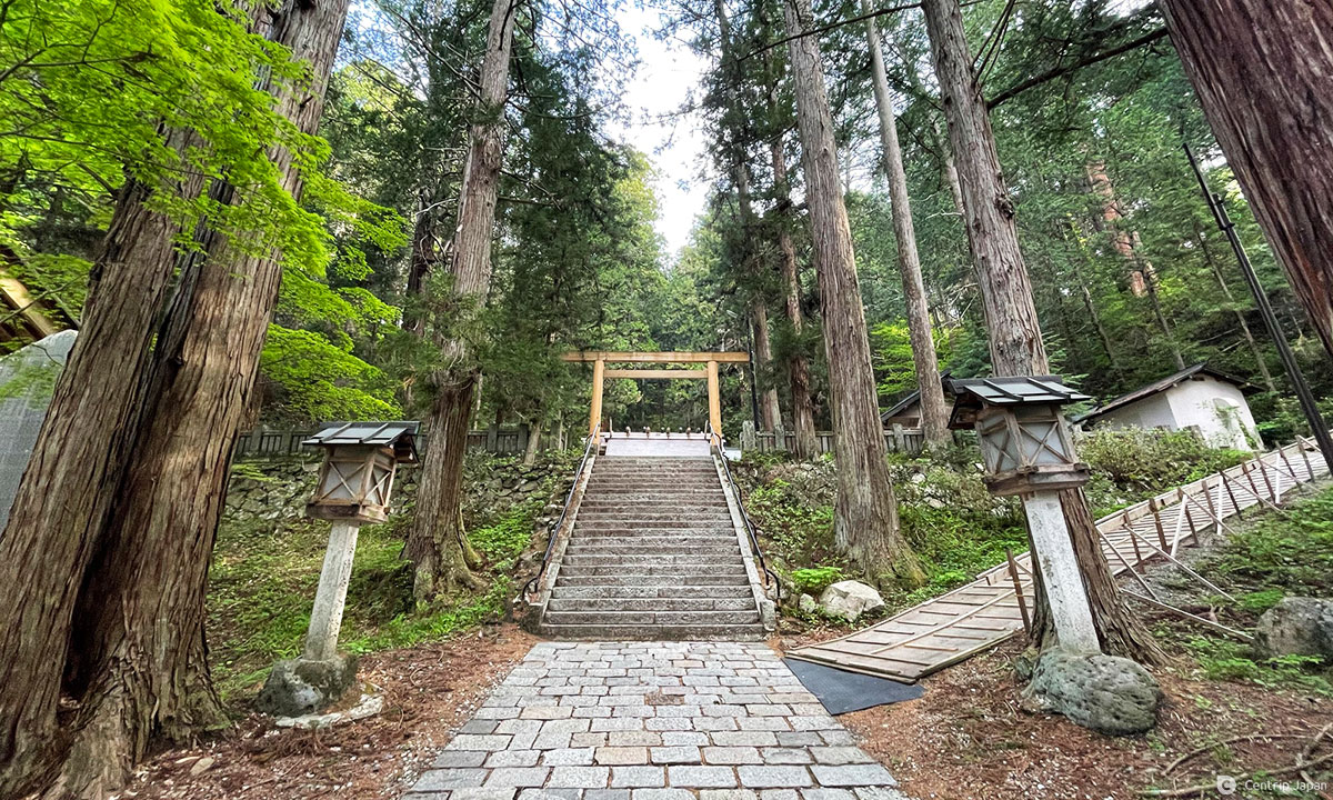
OMACHI: The Shio no Michi reaches Lake Aoki almost as soon as it enters Omachi. Lake Aoki is the first and largest of the “Nishina 3 Lakes” and is a popular and picturesque summer getaway destination for families offering SUP, kayaking, camping, canoeing and more. The Chikuni Kaido hugs the western banks and proceeds under a pleasant forest canopy, skirting past Lake Nakatsuna and Lake Kizaki in quick succession. Beyond the lakes the trail travels exclusively on pleasant paved roads along the outskirts of Omachi. A quick side trip to the fabulous Nishinashinmeigu Shrine is a must.
IKEDA: The Ikeda portion of the route is the shortest in terms of distance at roughly 9km and follows only paved roads. There are no standout must-see sights, but the verdant rice fields and immaculately manicured Japanese-style gardens surrounding well-kept traditional houses are impressive enough.
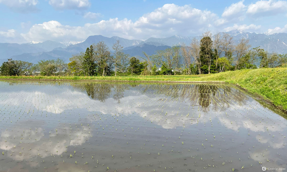
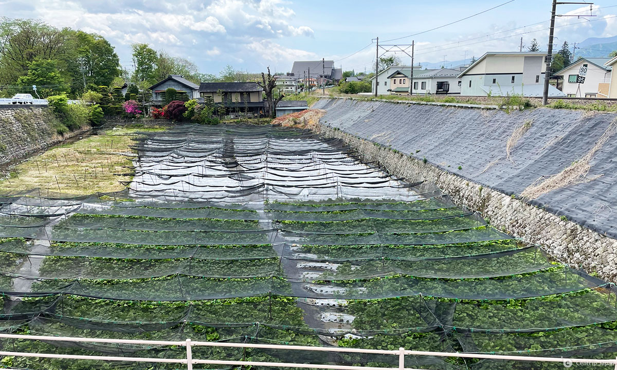
AZUMINO: The scenery in Azumino is similar to that of Ikeda’s rice fields and picture-perfect gardens, with a twist: wasabi farms. Azumino is the number one producer of wasabi in Japan owing to its abundant spring water, and the trail takes you in close proximity to a number of small-scale family-owned and run farms. Sticking to the “official” trail is tough at times, but it’s hard to get lost since the route essentially parallels the JR train line. The Hotaka Station / Shrine area is a nice place to rest, refresh and try some local wasabi products. If you are traveling the entire route, Azumino is a good option to stop for a day to rest or do some unrelated sightseeing, such as a cycling tour of the city.
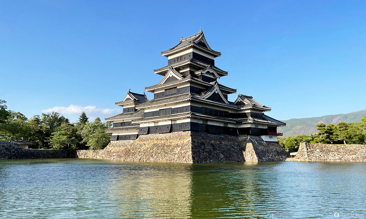
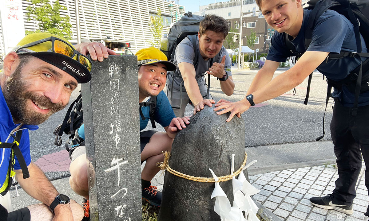
MATSUMOTO: To be honest, the best part of the Shio no Michi in Matsumoto is majestic Matsumoto Castle, which isn’t even located on the route itself. The path is largely unmarked, all on pavement and increasingly urban. Yet, modern Matsumoto still manages to retain many charming elements from its past and a visit to the wonderful castle should definitely be on the to-do list for anyone spending time in this area. The Chikuni Kaido officially concludes just south of the castle at the Ushitsunagi Ishi, a stone with a large hole in it that was used to tie up pack animals for the purpose of relieving them of the loads of salt they carried there.
Recommended Area to Visit: Otari
Even if you don’t have the time, stamina or desire to travel the Shio no Michi’s full length, there is no need to give up on the trail completely. In fact, as someone who has completed a thru-hike of the whole route I can wholeheartedly recommend the Otari area as a great place to experience the Chikuni Kaido. In the interest of full disclosure, I may be a little biased since my home is in Otari, but then again I found the area attractive enough to want to live here in the first place and the Shio no Michi is a big part of the allure.
Not to confuse things, but the Shio no Michi actually splits into two separate paths in Otari that travel on opposite sides of the Himekawa River before reconverging later on: the Chikuni Kaido (Chikuni Highway) and the Chikuni Kodo (Chikuni Old Road). Everything mentioned so far pertains to the former, which is the standard route, but the Kodo also has much to offer.
The trails in Otari are the most well maintained, and are divided into 8 different “model courses” varying in length from 6 to 12km.
Getting to Otari from Nagoya
The fastest and easiest way to get to Otari from Nagoya is to take the Limited Express Wide-View Shinano on the JR Line to Matsumoto Station and transfer to the Limited Express Azusa. It takes roughly 4 hours and costs a little more than ¥8,000 one way. Slower trains or a combination of bus and train are cheaper, but take more time.
Best Introductory Course: Chikuni-Goe
The Chikuni-Goe course is to the Shio no Michi what Tsumago and Magome are to the Nakasendo; a wonderful, easily accessed introduction to the route that’s suitable for a wide range of ages and fitness levels. It also happens to be the trail used for the annual Shio no Michi Matsuri (Salt Road Festival) held each year on the 3rd of May. The course can be walked in either direction, but starting in Tsugaike results in less overall elevation gain.
STARTING POINT: Tsugaike Kogen Ski Resort
ENDING POINT: Otari Village Yakuba
DISTANCE: Approximately 7km
TIME REQUIRED: Around 3 hours
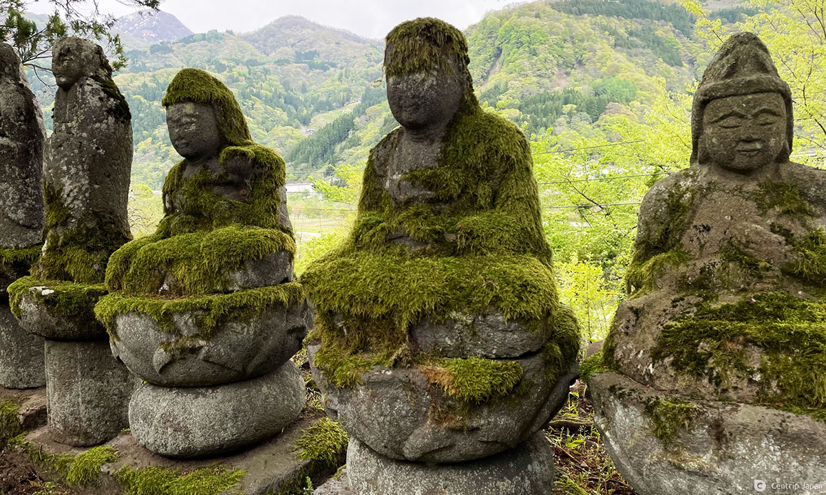
HIGHLIGHTS: The views of the Northern Alps are fantastic from Tsugaike, the collection of old stone statues forming the Maeyama Hyakutai Kannon are a sight to behold and the Ushikata Yado historic homestead, Chikuni no Sho guard station and Otari-mura Kyodo Kan folk museum are well worth the ¥500 ticket that gives you access to all three.
ACCESS: Local buses shuttle back and forth frequently from JR Minami Otari Station (on the Oito Line) to Tsugaike Kogen. It takes around 20 minutes to reach Tsugaike from the station, and from there you’ll need to make the short 3-minute walk east along the road from the rotary to reach the sign-posted trailhead on your left, immediately in front of Hotel Schanze. If you are having trouble finding the trail you can pop into the tourist information center right where you get off the bus. You’ll finish near the village town hall, from where it’s a short walk south along the main road back to Minami Otari Station.
Most Scenic Course: Oami Toge-Goe
The Oami Toge-Goe course is Otari’s showcase route and the one that people list time and time again as their favorite. Unlike the Chikuni-Goe course, this one is more isolated, rugged and a little harder to access, but worth the time and hassle if you can handle tough climbs and technical trails. This course actually straddles the border of Niigata and Nagano, starting in one and finishing in the other. It’s probably best to start in Oami on the Nagano side, climb to the pass and descend to Nechi on the Niigata side in order to avoid a steep descent on slippery trail going the other way.
STARTING POINT: Oami Settlement, Otari
ENDING POINT: Yamguchi Sekisho-ato, Nechi, Itoigawa
DISTANCE: Approximately 10km
TIME REQUIRED: Around 4 hours
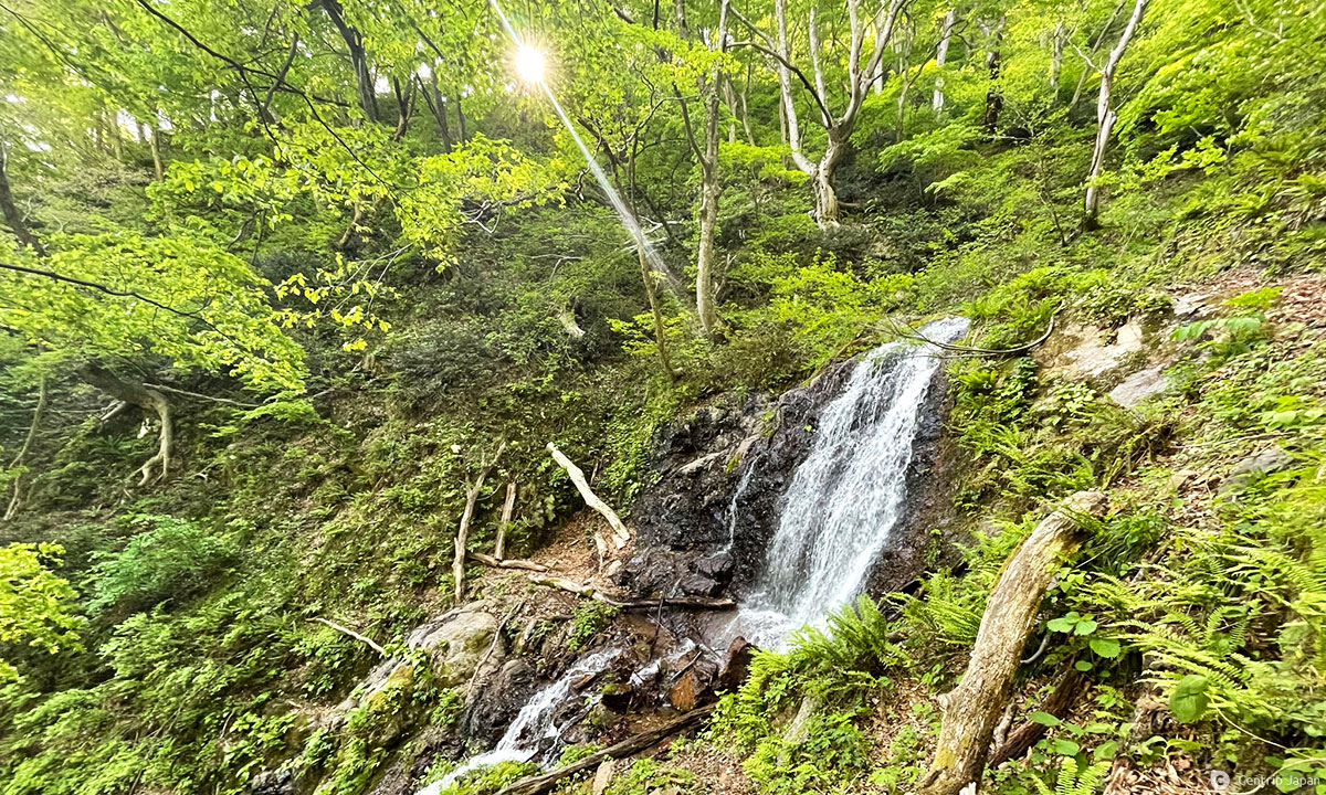
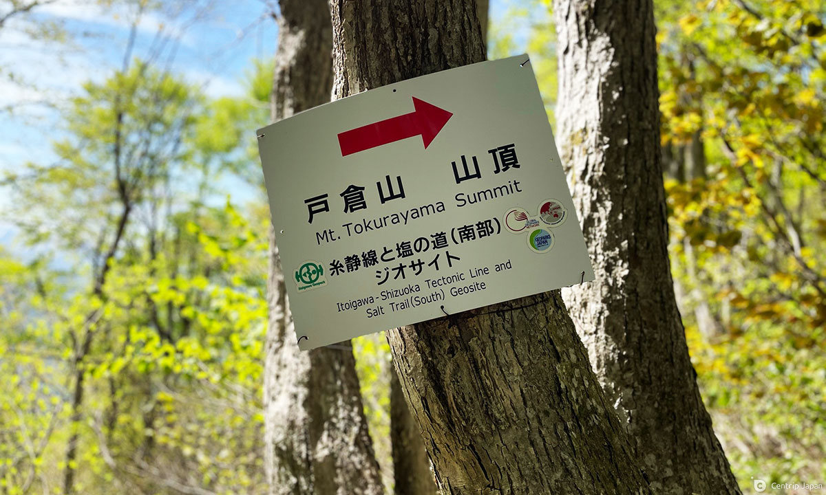
HIGHLIGHTS: The sleepy settlement of Oami is lovely in its own right, but the real draw is the nature. This course takes you on beautiful trails past waterfalls, through pristine beech forests and tops it all off with sweeping views of the Sea of Japan and surrounding mountains as well as the beautiful ponds of Shiroike and Kakumaike. As a bonus and for even better panoramic views, you could make the 2km out-and-back detour to the summit of Mt.
Tokura from the Kakumaike Pond.
ACCESS: Local buses on the Kita-Otari Line run somewhat regularly from JR Hiraiwa Station (on the Oito Line) to Oami. It takes around 10 minutes to reach Oami by bus, and after getting off you’ll walk from the small shrine in the middle of the settlement towards the northern end where the outermost houses meet the forest. Once you pop out on the other side of the trail at the Yamaguchi Sekisho-ato, you can take a 15-minute bus ride on the Nechi Line to JR Nechi Station. Trains here run rather infrequently, so be sure to check timetables in advance.
Chikuni Kaido: Summary
Walking along the Chikuni Kaido provides a rare and fantastic opportunity to walk in the footsteps of history and experience the beautiful landscapes and rich cultural heritage found in Japan’s countryside. Although it can be hard to come by information in English and the trail’s infrastructure is still being developed, that should slowly improve in the coming years. In the meantime if you fancy an adventure on a practically undiscovered historical trail, add part or all of this one to your list!
Click here to get the latest information on Central Japan.Centrip Japan - Nagoya and Chubu Information