
![]() |
Paul Deckret
|
Paul Deckret
Ogizawa Circuit Hike: A Thrilling 3-Day Walk in the Northern Alps

With the Obon holidays drawing to a close, students returning to classrooms across the country, and the cicadian symphony gradually fading from the seasonal soundscape, it's increasingly clear that fall is just around the corner. But don't be fooled, summer isn't ready to say goodbye just yet. While we’re certainly past the peak of sustained, steamy weather, let's not forget that September ranks as the third hottest and third most humid month of the year across the country. Japan's crowded, concrete cities can still feel oppressively hot well into the month; hot enough to have you dreaming of being somewhere else.
September is a Great Time for Hiking
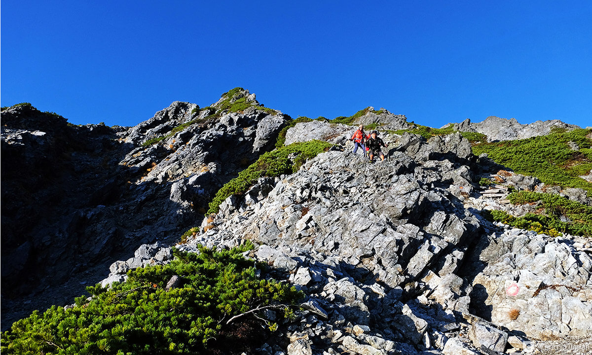
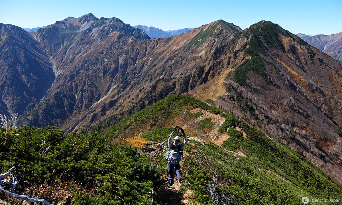
 Looking back towards the Tateyama mountain range while on approach to Mt. Jii
An alpine adventure is the perfect way to escape the heat and September is a great time to take advantage of the last remaining moderate weather before the onset of autumn: most huts are still operating, most buses are still running and there are noticeably less people on the trail than in July and August. If your goal is to beat the heat, climbing above the tree line is an excellent strategy since the temperature is said to drop roughly 6C for every gain in elevation of 1,000m. By that math, trading the sea-level streets of a large Japanese city for a trail to the summit of a 2,000m+ mountaintop is a guaranteed way to say goodbye to ‘balmy' and hello to ‘brisk.'
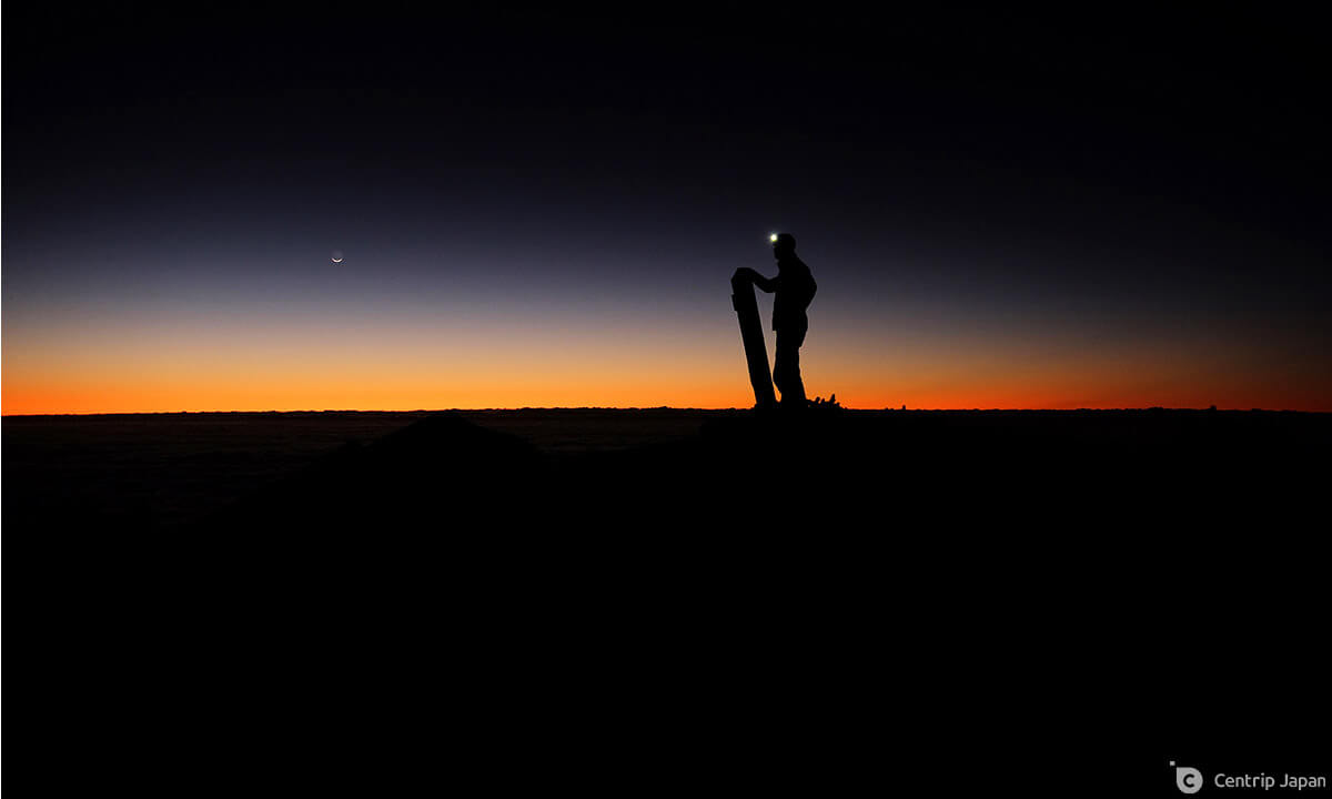
 Sunrise from the summit of Mt. Harinoki, on a chilly September morning
On the other hand, while daytime highs in the mountains might seem comfortably cool during this season, early morning and overnight temperatures can drop to near or below freezing, so it is absolutely necessary to be prepared with proper camping equipment and plenty of warm layers.
The Northern Alps are Superb
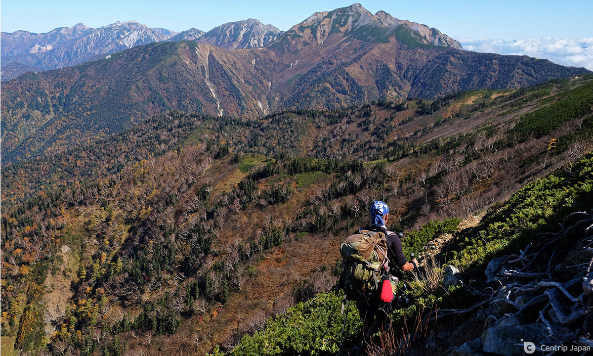
 Afternoon clouds build up along the ridge, as seen from the Harinoki mountain hut
As a country composed of more than 70% mountains, Japan is spoiled for choice when it comes to amazing hiking areas, but I myself have always been partial to rocky ridges above the trees and the panoramic views they afford. The Chubu area's Nagano Prefecture is home to the majority of Japan’s tallest and most impressive mountain ranges, the Northern, Central, and Southern Alps, and thus the best place to head for high alpine hiking. While each of the Alps has plenty to offer, the Northern Alps are where I find myself going back to time and time again.
Yet the Northern Alps alone contain well over a hundred peaks and stretch across a huge swath of land, so narrowing down a destination can be a daunting task. Below I'll introduce one of my favorite multi-day hikes that combines a lot of the best qualities of the area (easy access, extended ridge walking, spectacular scenery), while also being less congested than some of the major, big-name routes such as those around Kamikochi. As an added bonus, it’s a loop, making it convenient for those traveling by car as well.
3-Day Ogizawa Circuit Hike
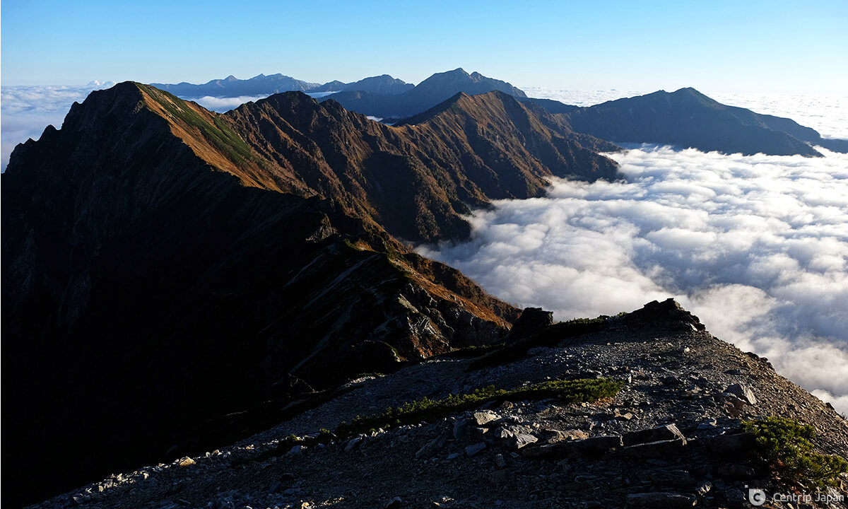
 Hiking above the clouds on the way to Mt. Akasawa
Hike Overview
Omachi lies at the base of the Northern Alps near the heart of the range, and has long been hailed as one of the main gateways to the Alps. One of the most popular access points is Ogizawa Station - known chiefly as the boarding point on the Nagano side for the popular Kurobe Dam and Tateyama Kurobe Alpine Route. It also happens to be the location of several trailheads leading directly to some fantastic hiking; primarily the peaks of Mt. Harinoki (針ノ木岳) and Mt. Jii (爺ヶ岳). And while it is possible to climb one or the other as a long out-and-back single-day or overnight hike, the beautiful ridge that links them together into a large 3-day loop is an attraction all its own and makes for one of the best walks in the area. It’s this route that I’m referring to when using the unofficial moniker, 'Ogizawa Circuit Hike.'
Hike Details
During the course of three full days on the trail as described over the following paragraphs, you'll summit six separate peaks, each standing in excess of 2,600 meters, with the option to add one more. Overall this is a tough, but exceptionally rewarding hike, loaded with epic views, spectacular summits and satisfying ridge walking. It's possible to stay overnight and eat in the mountain huts, or to carry your own tent and food, and camp at the designated tent sites adjacent to the huts. Read on for the day-by-day route summary.
Day 1 - 5.3km / +1,115m / Approx. 5 hours
 A trail marker along the path near the start of the hike to Mt. Harinoki
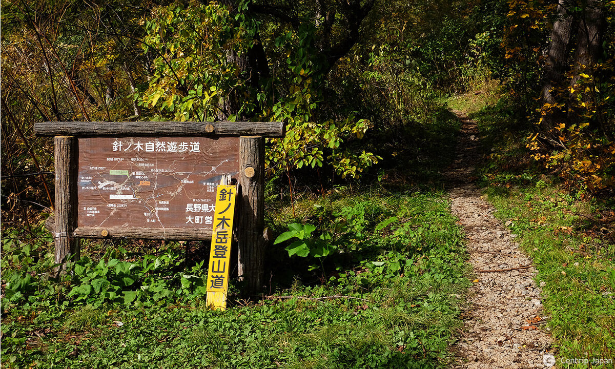
Things kick off from Ogizawa Station, located at an elevation of 1,433m. The trailhead for Mt. Harinoki is located to the left of the station at the edge of the paved parking lot. From there the trail travels through the forest, more or less paralleling the road and emerging onto it several times during the first kilometer before settling into the trees more permanently. Continuing on there are several small stream (boulder field) crossings before reaching the small Osawa Hut (大沢小屋). This is more or less the halfway point of day 1 in terms of distance, and a good place to take a break. In a normal year, the hut operates from early July to early September, but it's now been closed for the past two seasons due to the pandemic.
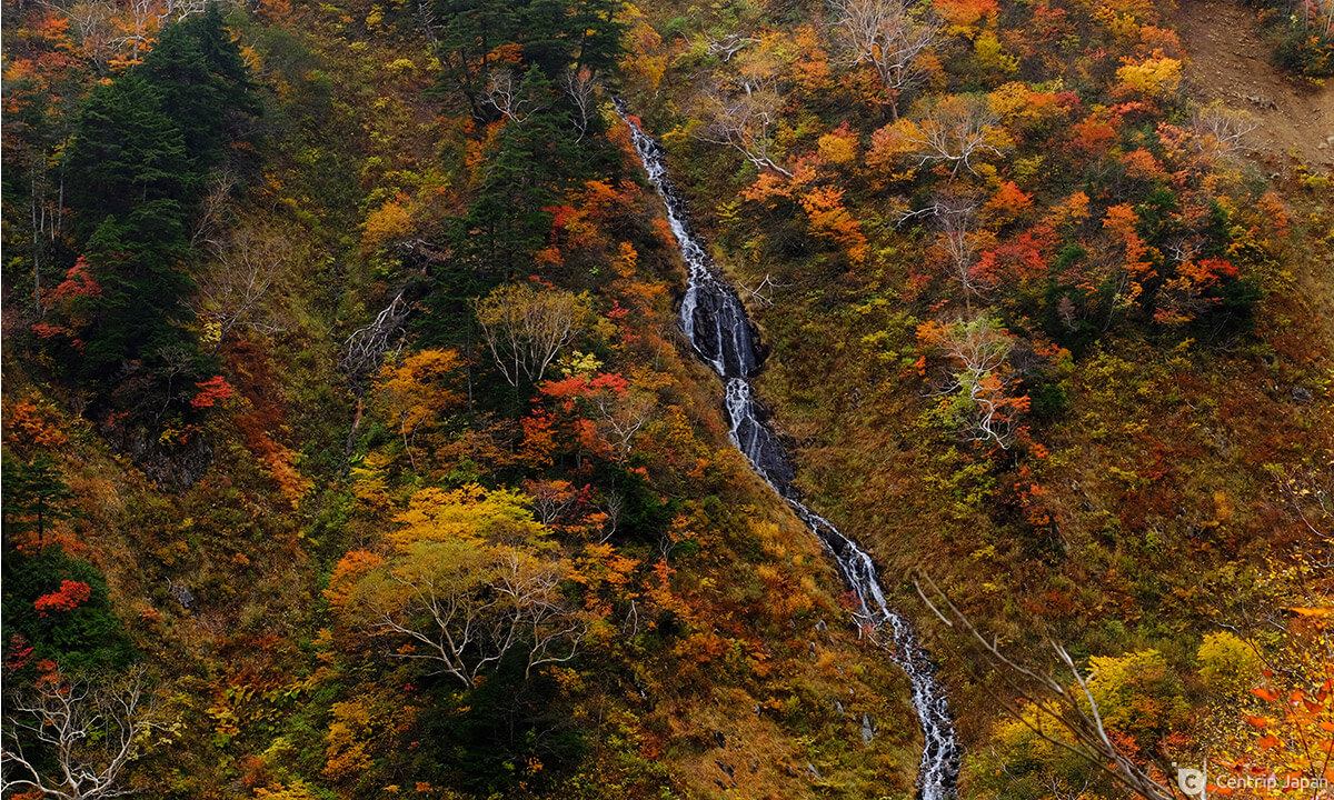 Beautiful fall colors compliment a waterfall cascading down the mountainside, as seen from the trail
While it's been a slow, steady gain in elevation to this point, it gets significantly steeper from here and stays that way all the way to the Harinoki Hut (針ノ木小屋). Leaving the Osawa Hut the trail carries you towards the center of a large v-shaped valley, traversing the lower portion of the mountainside for another kilometer or so before bringing you down to the riverbed at the valley center. For a good portion of the year, this is a large snowfield, recognized as one of the three major snowfields of the Northern Alps (北アルプス三大雪渓), but by September much of it has melted and the route avoids most of what remains with the possible exception of a few small traverses. It's a good idea to check up-to-date route conditions before setting out or pack chain spikes or 4-point crampons just in case.
 In early summer this is a giant snowfield, but by September most of it has melted
The trail skirts the edge of the river and heads straight up the fall line, narrowing briefly before opening up again towards the top, and switchbacking mercifully on the final approach to the saddle and the hut. This is your destination for day one, which you should reach in roughly five to six hours after setting out. If you have the time and energy after checking in, you can drop your bags and make a side trip to the summit of nearby Mt. Renge (蓮華岳), a two-hour round trip.
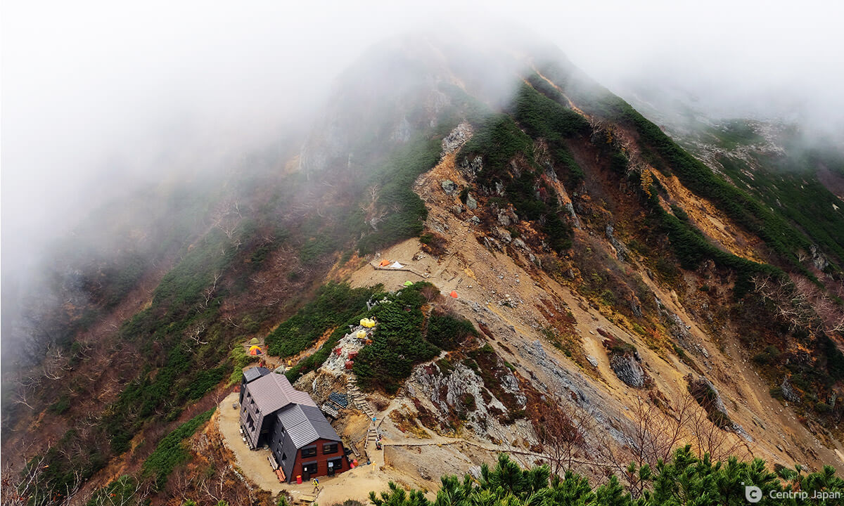 Looking down on the Harinoki hut and campground from the trail leading towards Mt. Renge
Day 2 - 10.2km / +800m / Approx. 8 hours
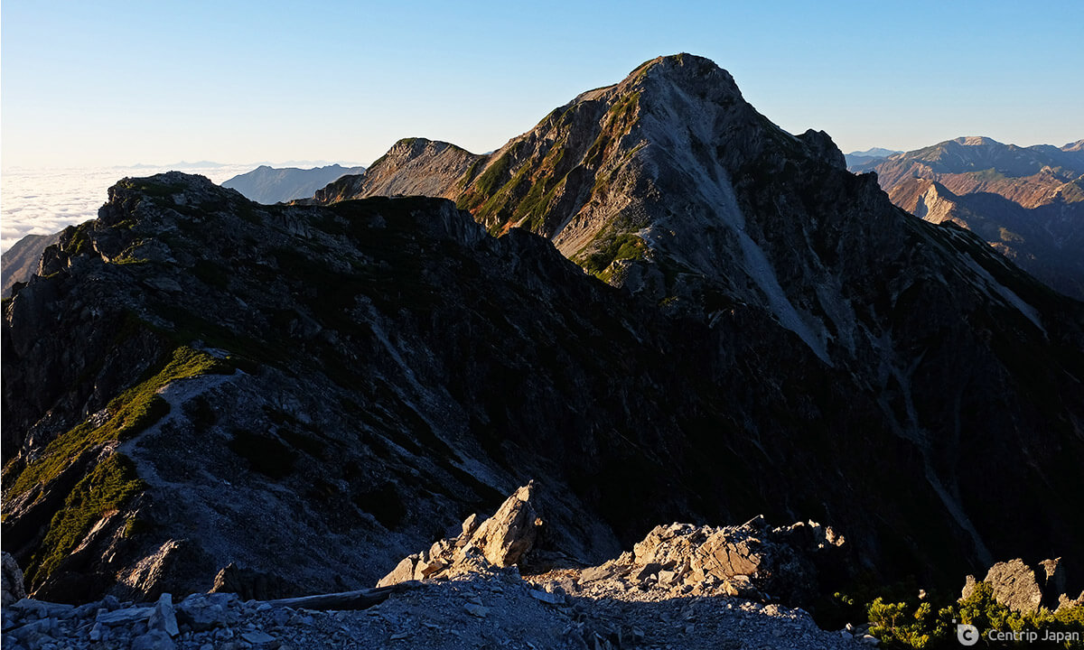 Looking back at the impressively-shaped peak of Mt. Harinoki
Today is the highlight of the hike; the thrilling walk along the picturesque rocky ridgeline with panoramic views throughout. The distance is nearly double that of day one, but with only 2/3 the elevation gain. When you say it that way it doesn't sound so bad, but the elevation chart for this section looks very much like a rollercoaster with a series of big ups and downs, and you should budget a full 8 hours to complete the ride. An early start is a must.
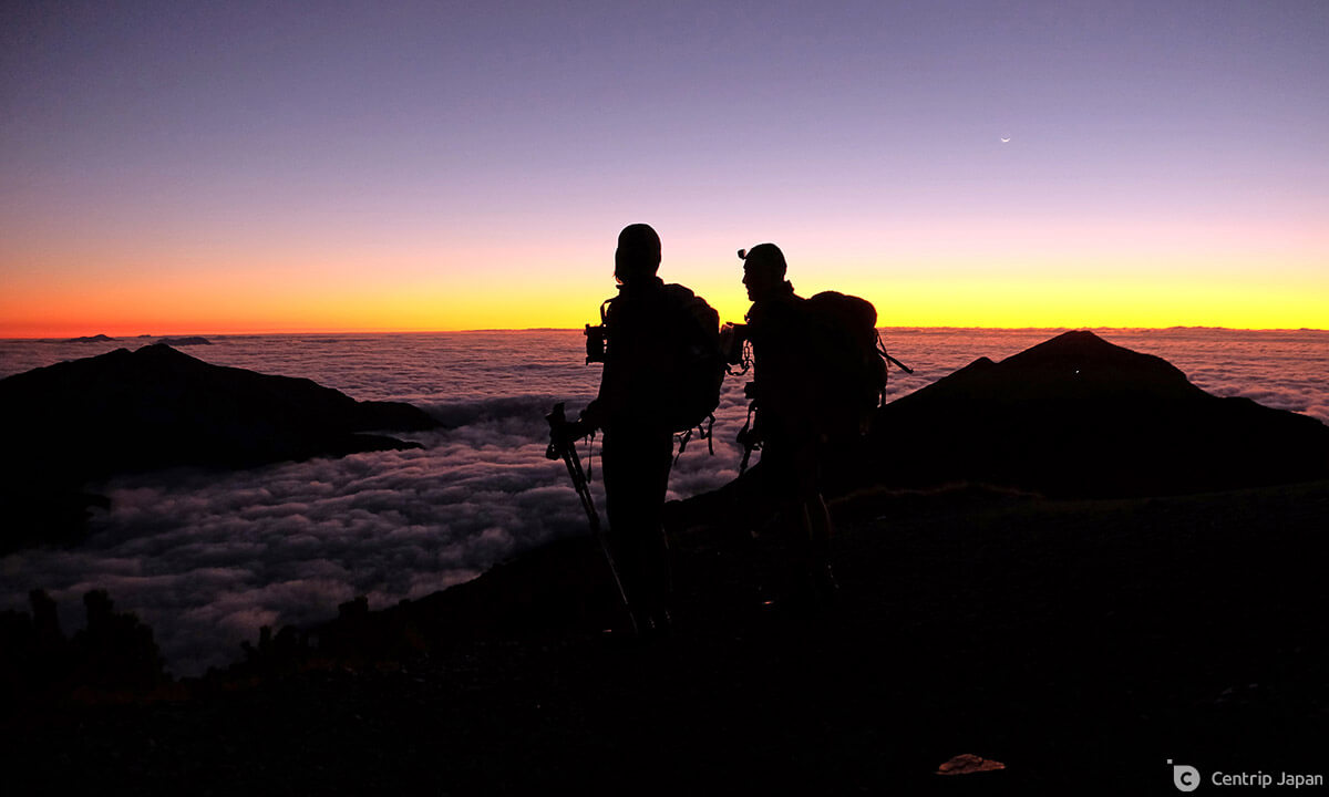
 Standing on the broad summit of Mt. Harinoki, waiting for the sunrise
Immediately upon leaving the hut you'll climb sharply towards the summit of Mt. Harinoki, gaining more than 250m in just less than one kilometer. It's tough, but the summit views of Tsurugi and Tateyama floating above the cobalt blue waters of Kurobe Lake are epic and should help you quickly forget about your tired legs. If you start out in darkness and time it right, you may be lucky enough to catch the first rays of daylight coloring the top of Tateyama in pastel shades of pink.
 Alpenglow shining across the summit of Tateyama, with Kurobe Lake below
From here you simply follow the ridge, descending first on rocky terrain before leveling out and climbing slightly again towards the top of the next peak, Mt. Subari (スバリ岳). The pattern repeats with descents and climbs of Mt. Akasawa (赤沢岳) and Mt. Narusawa (鳴沢岳) - the day's midpoint.
 Descending Mt. Subari on rough, rocky terrain
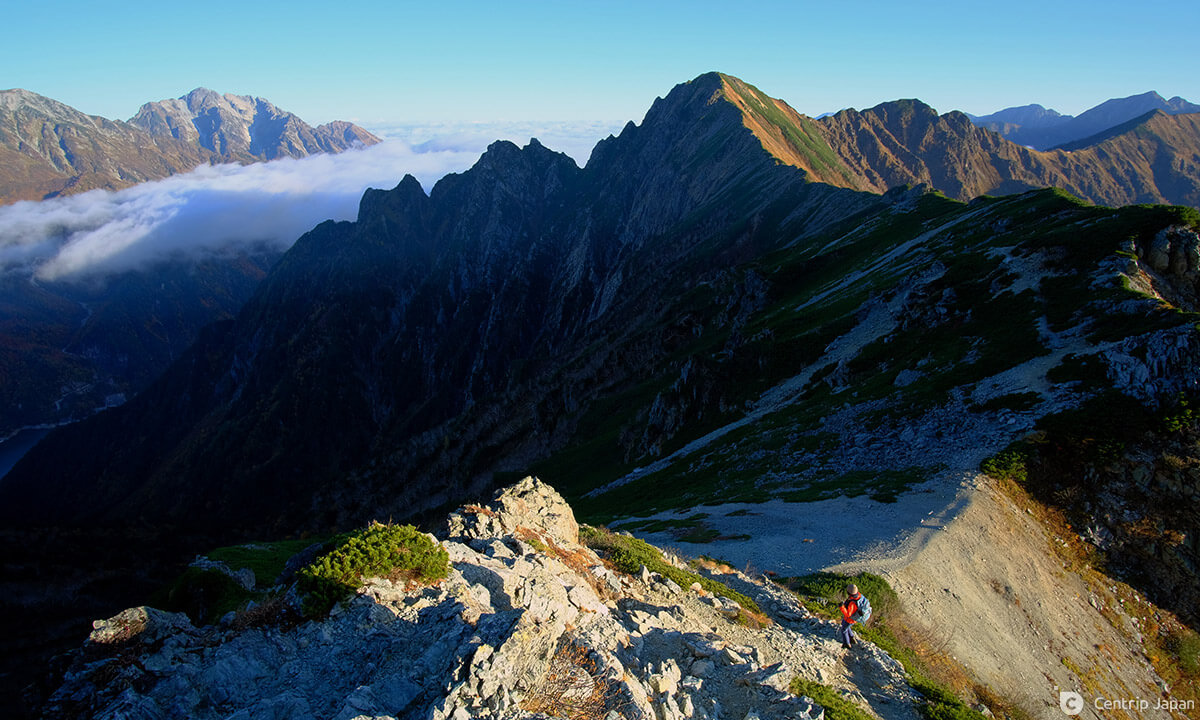
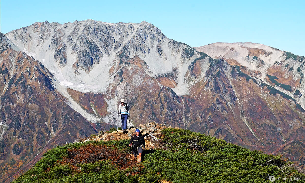
 Day 2 takes you along this fabulous ridge, with views of Mt. Shirouma and beyond in good weather
From Narusawa it's a short 30-minute walk to the Shinkoshi Hut (新越山荘), a cozy lodge that offers overnight stays during the peak summer hiking season, but unfortunately closes in mid-August. Without this option for resupply, it is imperative to carry all the food and drinks you need for the entire day's walk.
 From some spots on the trail, Tateyama looks so close you can almost touch it
 The Shinkoshi hut can be seen here in the background
Departing the Shinkoshi hut, you'll find yourself once again heading up, in the direction of yet another summit - Mt. Iwakoyazawa (岩小屋沢岳). The good news is that this is the penultimate climb of the day, and the biggest one remaining (~175m), though not the last. You may also notice that while the terrain underfoot was rocky, rough and technical at times early in the day, things have been slowly smoothing out and the character of the ridge seems to be changing, almost mellowing. This becomes even more apparent on the long, gradual descent from Iwakoyazawa.
 Less rock and more vegetation are characteristics of the trail as you get closer to the Taneike hut
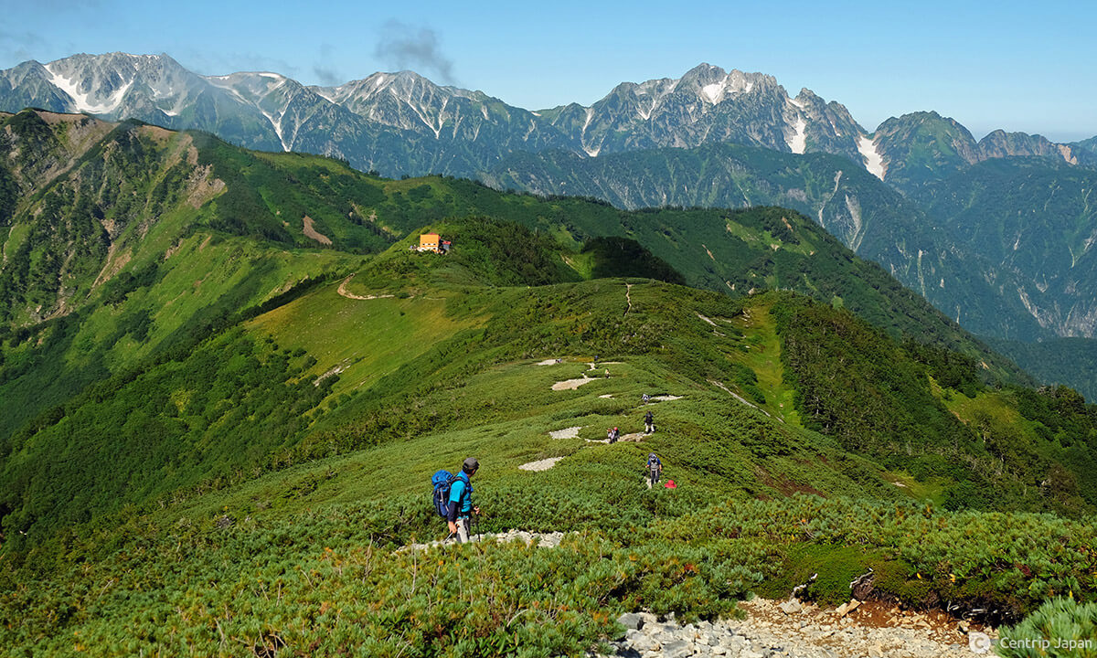
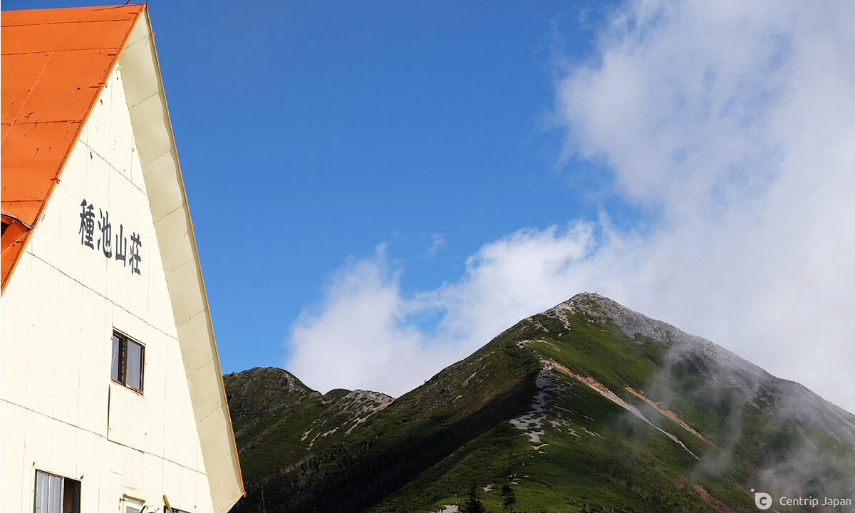
The path deviates slightly from the ridge and carries you through a belt of thick pine brush and later stands of evergreens. Before long you'll see a few small ponds come into view, and from there one final 80m climb is all that stands between you and the orange-roofed Taneike Hut (種池山荘).
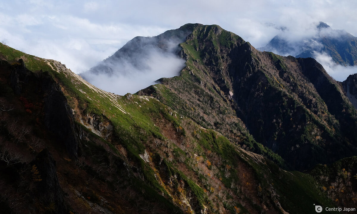
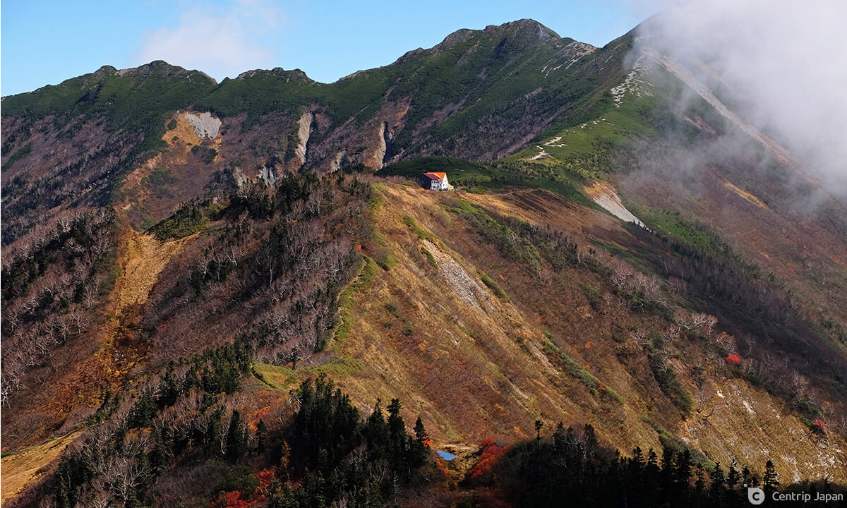 Taneike hut sits majestically on the ridge, with Mt. Jii partially shrouded in clouds
Day 3 - 8.9km / +260m / Approx. 4.5 hours
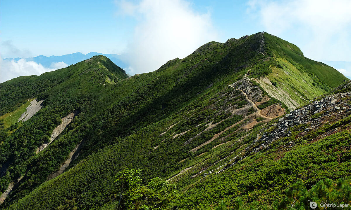 Looking out towards the very green summit of Mt. Jii in early September
After an intense first two days, this one is more or less a victory lap. The path to Ogizawa leads down directly from the front of the hut, but with the summit of Mt. Jii tantalizingly close it would be an absolute shame to skip it. Instead, leave your main bulky pack at the hut, stuff some essentials in your pockets and make quick work of the pleasant 3km out-and-back. Without shouldering the weight of a full pack, you can expect to make the return trip in around an hour and a half on the well-maintained trail. Once back at the hut be sure to stock up on food and drinks for the way down if necessary, as there are no options to do so along the way.
 Taneike hut and Mt. Jii
The 5km descent is done on a trail known as the Kashiwabara Shindo (柏原新道), and while not particularly difficult, it descends at an average gradient of more than 20% and occasionally passes over rocky terrain that can be hard to develop a rhythm on.
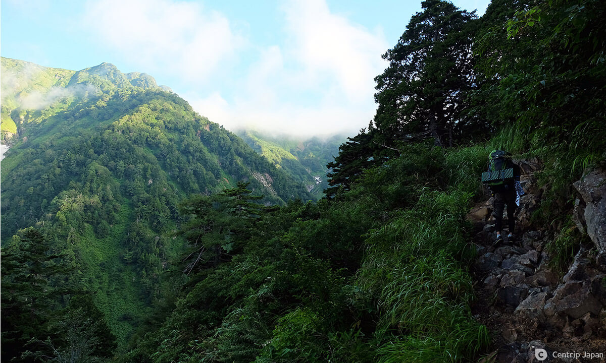 A hiker heading up a rocky section of the Kashiwabara Shindo, towards the Taneike hut
There's no need to rush though, and as the trail traverses down the mountain be sure to look over your right shoulder occasionally to catch glimpses of the ridge and the Taneike hut as it gets smaller and smaller. There are also several vantage points from which to spy Ogizawa Station off in the distance in front of you by which you can gauge your progress. Once you can hear the sound of the river, you'll know you're close to the end. The trail pops out onto the main road, and you'll want to turn right, cross the bridge and proceed along the pavement for the final kilometer, emerging from the tunnel to the main parking lot and bus stop.
 Ogizawa Station, the ending point of the hike, as seen during the final descent
Route Data
Starting / Ending Point: Ogizawa Station
Day 1 Route: Ogizawa Station (扇沢駅) ~ Harinoki Trailhead (針ノ木登山口) ~ Ozawa Hut (大沢小屋) ~ Harinoki Hut (針ノ木小屋)
Day 2 Route: Harinoki Hut (針ノ木小屋) ~ Mt. Harinoki (針ノ木岳) ~ Mt. Subari (スバリ岳) ~ Mt. Akasawa (赤沢岳) ~ Mt. Narusawa (鳴沢岳) ~ Mt. Iwakoyazawa (岩小屋沢岳) ~ Taneike Hut (種池山荘)
Day 3 Route: Taneike Hut (種池山荘) ~ Mt. Jii (爺ヶ岳) ~ Taneike Hut (種池山荘) ~ Kashiwabara Trailhead (柏原新道登山口) ~ Ogizawa Station (扇沢駅)
Total Elevation: +2,175m
Total Distance: 24.4km
Total Walking Time: 17.5 hours
Planning Your Hike
Access
The fastest and easiest way to get to Omachi from Nagoya is to take the Limited Express Wide-View Shinano on the JR Line to Matsumoto Station and transfer to a local train on the Oito Line bound for Shinano Omachi. It takes roughly 3.5 hours and costs just under ¥7,000 one way for a reserved seat.
From the bus stop directly in front of Shinano Omachi station hop on one of the 5 daily departures bound for Ogizawa Station (9:25 / 10:10 / 11:40 / 14:10 / 15:40). The one-way trip takes 35 minutes.
Mountain Huts
In the age of COVID, most huts require you to reserve in advance and this is true for both the Harinoki and Taneike Huts. Both locations offer limited spots for camping as well, with the huts asking that you book in advance on weekends and holidays. While Taneike Hut is open until 10/16 for the 2021 season, please be aware that Harinoki Hut has not announced their closing date, saying only that they will close "sometime in September." Please check directly with the hut before finalizing your plans, in order to confirm their status, availability and prices. (Websites in Japanese only.)
Harinoki Hut: http://www.harinoki.com/hut.html
Taneike Hut: https://www.kasimayari.jp/annai.htm
When to Go
As long as you are prepared with the right gear and clothing and the huts are still open, this hike is usually doable right up until the beginning to middle of October. As mentioned previously, if going before September you need to be equipped to climb on snow.
Click here to get the latest information on Central Japan.Centrip Japan - Nagoya and Chubu Information