
![]() |
Centrip Editorial Board
|
Centrip Editorial Board
Walking The Tokaido Highway: The Other Samurai Trail

During the Edo period (1603-1867), two major highways linked Edo (Tokyo) and Kyoto. One was the Tokaido Highway, which ran along the sea coast, and the other was the Nakasendo Highway, which ran inland and through the mountains.
For overseas tourists interested in Japan's samurai ninja culture, the Nakasendo Highway may be more familiar than the Tokaido Highway, a route that even bears the name Tokaido on the Shinkansen bullet train. The Nakasendo, especially the mountainous route known as Kisoji, was introduced by the BBC as a walking route where visitors can enjoy the scenery of old Japanese roads and historic post towns, and has attracted many international tourists.
Related articles
The Tokaido Highway, on the other hand, underwent several changes since the start of the modern era. However, the name remains indelible, even lending itself to the Tokaido Shinkansen, Japan's main transportation artery and main roads. But places, where visitors can enjoy the historical atmosphere of the former highway and the post towns, are few and far between. However, there are many attractive spots along the Tokaido Highway where visitors can easily stop by on a half to full-day itinerary while staying in cities such as Nagoya, thanks to its convenient transportation system.
This article introduces three Tokaido Highway post towns (Atsuta Miya-juku, Seki-juku, and Tsuchiyama-juku) and a town that developed along the highway (Arimatsu) in the Chubu area. These towns are easily accessible from Chubu International Airport and Nagoya, and a one-day hiking course on the Tokaido Highway that walks between the Seki-juku and Tsuchiyama-juku sections.
Table of Contents
Atsuta Miya-juku(Aichi Prefecture)
Miya-juku, the 41st stop on the 53 Stations of the Tokaido Highway from Edo (now Tokyo), is in Atsuta Ward, Nagoya City. Although Atsuta is now a ward of Nagoya City, it has such a long history that the locals proudly say, "Atsuta was here first, and Nagoya was established later."
In former times, the town was established as the gateway to Atsuta Shrine, and from the Edo Era onward, it further prospered as a post town on the Tokaido Highway. By the end of the Edo Era (mid-19th century), it became the largest post town on the Tokaido Highway, with two main inns (accommodations for court nobles and feudal lords) and a subsidiary inn (the second most prestigious accommodation after the main inn), along with nearly 250 inns (general lodgings).
From Miya-juku to Kuwana-juku, the next stop on the 42nd itinerary was a sea route called Shichiri no Watashi, where travelers crossed the sea by boat for a distance of 7 ri (about 27 to 28 km). The area around Miya-juku underwent redevelopment during the process of modernization, leaving few places where one can still feel the vestiges of the old post town, but the ruins of the old landing place were restored as Miya no Watashi Park, complete with a night light and a bell to tell the time.
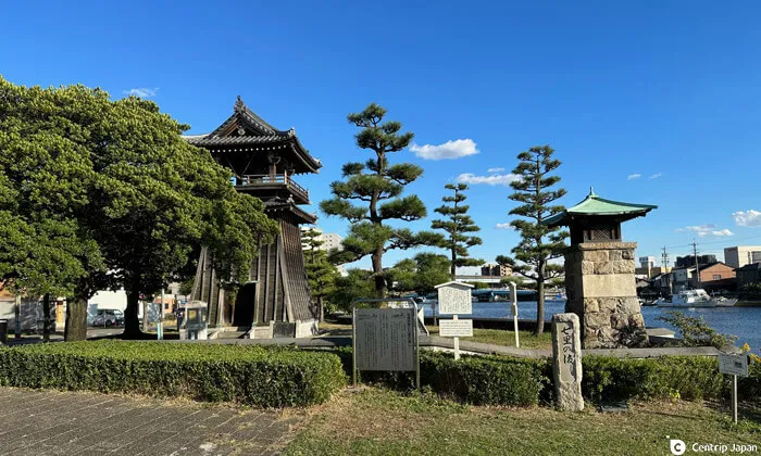 Night Light Tower and Bell of Time in Miya no Watashi Park
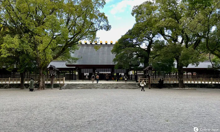 The main shrine of Atsuta Jingu, which still attracts the faithful
Nearby Miya no Watashi Park is Atsuta Jingu Shrine, a Shinto shrine dedicated to the Kusanagi-no-Tsurugi ( literally, Grass-Mowing Sword), one of the three sacred regalia, and a place of worship for samurai since ancient times. Nobunaga Oda, one of the greatest figures of the Warring States period, is said to have gone to Atsuta Shrine to pray for victory before the Battle of Okehazama, the decisive battle that determined his destiny (and that of the Warring States period). The Nobunaga Fence is said to be dedicated by Nobunaga after his victorious battle and remains in the shrine precincts.
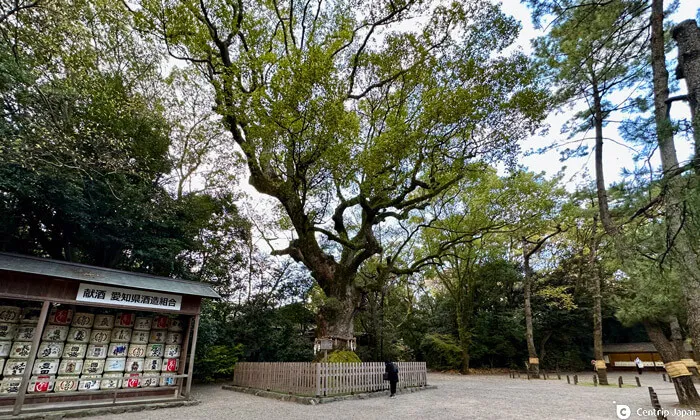 A large camphor tree believed to be over 1,000 years old
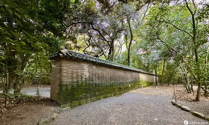 The Nobunaga Fence dedicated by its namesake
Old streets of Arimatsu (Aichi Prefecture)
The Arimatsu district of Nagoya City is near the Okehazama ancient battlefield where Nobunaga fought.
 Igetaya, a leading tie-dye wholesaler in Arimatsu
 The old town continues for about 800m
Arimatsu was originally a teahouse community between the 39th and 40th stops on the Tokaido Highway, Chiryu-juku, and Narumi, respectively. It prospered greatly during the Edo period as a production center of Arimatsu Shibori, tie-dyed fabric. Travelers on the Tokaido Highway competed to buy Arimatsu Shibori hand towels and yukata (summer kimono). The streets lined with prosperous merchant houses still tell the story of the prosperity of the past.
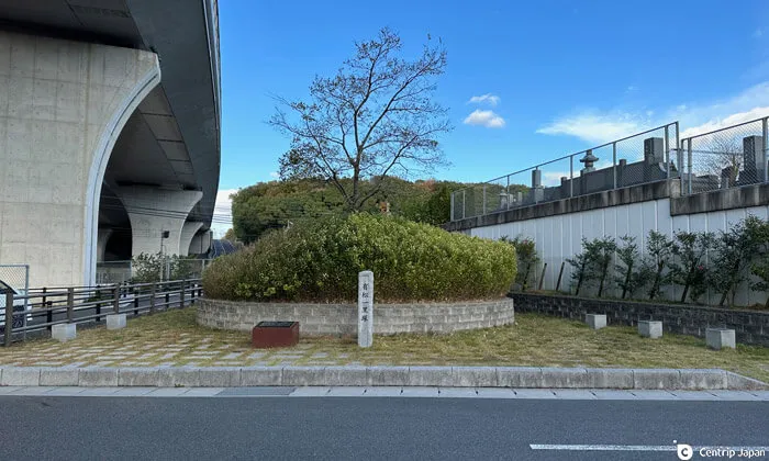 Arimatsu Ichirizuka (mileposts placed every 4 km) marking the old Tokaido Highway
 Skilled craftspeople demonstrate their work at the tie-dye hall
Arimatsu Shibori developed under the protection of the Owari Clan in the early Edo period (1603-1868). Cloth is tied up and dyed to create various patterns. Even today, about 200 craftsmen are active in the industry, and you can see demonstrations by skilled artisans at the Arimatsu-Narumi Shibori Kaikan. At the workshops scattered throughout Arimatsu, visitors can experience the process of making a scarf with their own original pattern in about one hour.
Related articles
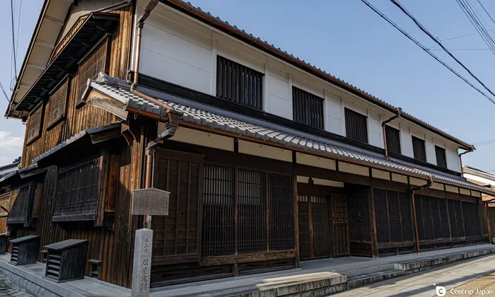
Seki-juku (Mie Prefecture)
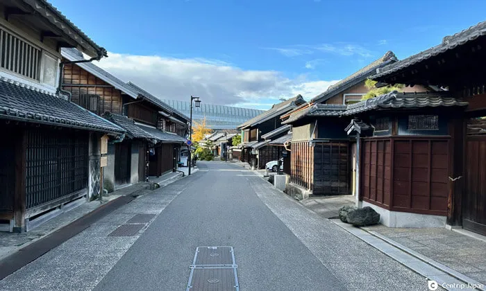
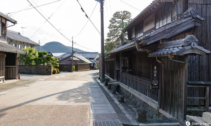
Of the 53 Stops on the Tokaido Highway, Seki-juku, the 47th stop, is the town that retains most of its original atmosphere. From early on, the entire community of Seki-juku engaged in a townscape preservation movement. The 1.8km stretch of buildings that preserve the atmosphere of the old days, from the east end to the west end of the town, is breathtaking, and one feels as if they have stepped back in time.
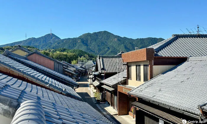 Tokaido Highway as seen from Choukantei
 A post office stands on the site of the former Kosatsu (notice board)
There are many places of interest in Seki-juku, such as "Choukantei", a viewing spot overlooking the entire post town, and "Tamaya Historical Museum," an Edo period inn. There are also many long-established Japanese confectionery stores, stores selling Ise tea, and fashionable cafes inside historical buildings, making it fun to walk around the town.
 The old town preserved for a stretch of 1.8 km
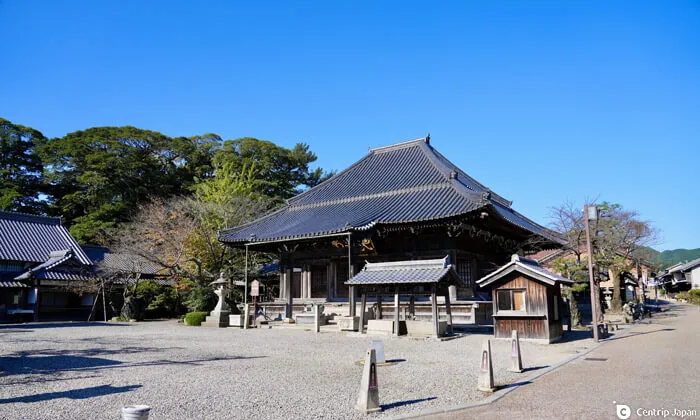 Jizoin Temple, a symbol of Seki-juku
To reach Seki-juku from Nagoya by public transportation, take the JR Kansai Honsen line to Kameyama, then transfer to the Kansai Honsen line and get off at Seki station (about 1 hour and 15 minutes). By car, it takes about one hour.
Related articles
Tsuchiyama-juku (Shiga Prefecture)
Two stops before Seki-juku is the 49th inn, Tsuchiyama-juku. The Tokaido Highway includes the steep passes of Hakone Pass, Yubi-Bosatsu Pass, and Suzuka Pass, known as the three most difficult passes on the Tokaido Highway. Tsuchiyama-juku, at the foot of the Suzuka Pass, was a busy lodging town where many travelers stopped to rest their feet. The main inn was established when Iemitsu, the third shogun of the Edo Shogunate, was on his way to Kyoto and was used by the emperor and other prestigious feudal lords thereafter. The stately Honjin still retains the tools and lodging books used in those days (*Advance reservations are required to visit the Honjin).
 Ruins of wholesaler's house in Tsuchiyama-juku
 Road leading to Kyoto
If you want to learn about the history of Tsuchiyama-juku in a compact manner, visit the Tokaido Denmakan. It is a museum housed in a renovated private house dating back to the late Edo period, with interesting exhibits including a diorama of Tsuchiyama-juku and a model showing the procession of feudal lords that passed through Tsuchiyama-juku during the Edo period.
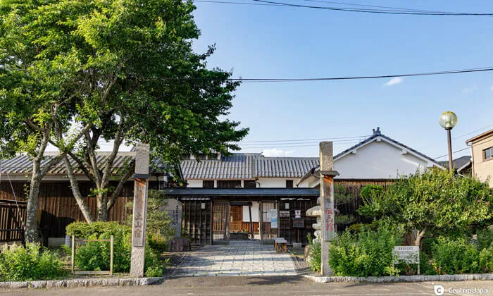 Tokaido Denma-kan
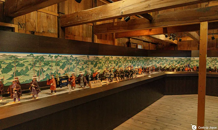 Daimyo Gyoretsu (feudal lord's procession) reproduced with 100 dolls
In addition, Koka City in Shiga Prefecture, where the Tsuchiyama Inn is, is a famous Iga ninja village. If you are interested in ninja and samurai, visit the Tourist Information Center Kogaryu Real Ninja Museum and the Koka Ninja Village in Koka City, to learn about ninja and experience ninja culture.
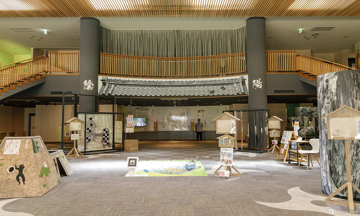 The Kogaryu Real Ninja Museum, where you can learn about the ninja in a fun way
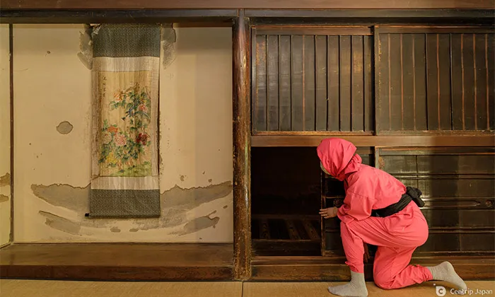 Karakuri Yashiki at Koka Ninja Village
Related articles
Hiking on Tokaido Highway - crossing the Suzuka Pass
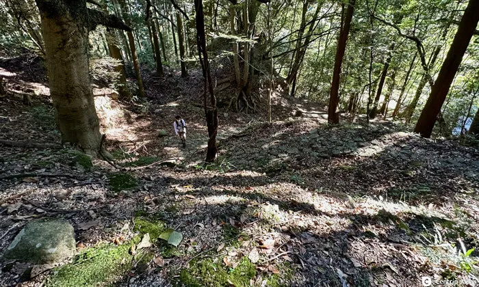
In addition to visiting each post town, visitors can experience how it used to feel to be a samurai as they walk along the Tokaido Highway between the post towns.
The Tokaido Highway is more developed than the Nakasendo Highway in modern times, so there are only a limited number of sections along the highway that are scenic and suitable for hiking. However, the route starting from Seki-juku, introduced above, and crossing Sakashita-juku and Suzuka Pass, considered a difficult point, to Tsuchiyama-juku is one of the most attractive hiking routes along the Tokaido Highway.
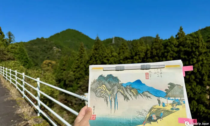 Fudesuteyama, visible from the old Tokaido Highway, is depicted in Ukiyoe as a scenic spot.
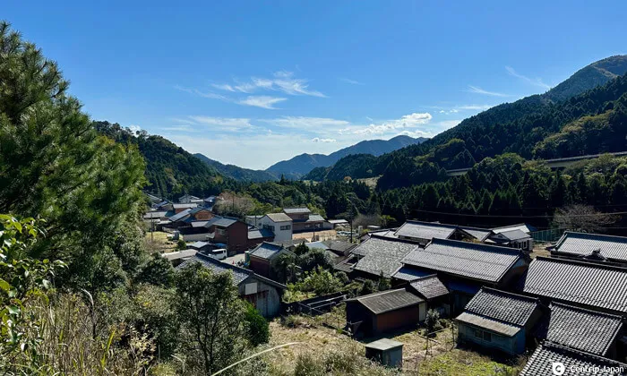 The townscape of Sakashita-juku, the 48th inn
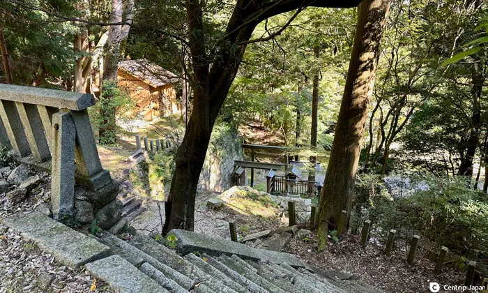
On the route from Seki-juku to the Suzuka Pass, there are many sights to see, such as the peaceful mountain village scenery around Sakashita-juku, the mysterious atmosphere of Katayama Shrine, and the old stone pavement of Suzuka Pass. You will never get tired of walking along the route.
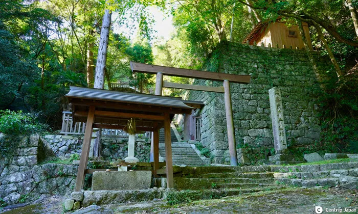 Katayama Shrine before the Suzuka Pass. A sturdy stone wall is here that looks like the remains of a castle.
 The main shrine was destroyed by fire in recent years, but a solemn atmosphere can be felt.
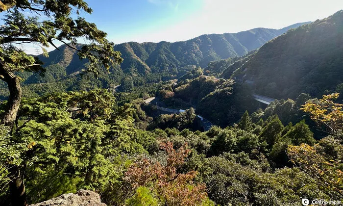
Although Suzuka Pass is not very high at 357m above sea level, the incline from Seki-juku and Sakashita-juku is particularly steep, with a 100m difference in elevation, making the hike up the pass very demanding. Immerse yourself as you hike, stepping on the old stone paths that have survived since the Edo period, and get in touch with the spirit of travelers of yesteryear.
 Suzuka Pass: the slope is very steep on the Mie Prefecture side, where the Seki-juku is
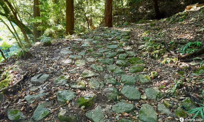 The stone path at Suzuka Pass enhances the mood. These sections are rare on the Tokaido Highway.
Near the top of Suzuka Pass is Kagami-iwa (mirror rock), also known as Oni no Sugatami. Legend has it that bandits living in large numbers on the Suzuka Pass attacked travelers who saw their reflections on this rock. It is an interesting anecdote about the difficulties of traveling the deep forests of the Tokaido Highway.
 The area around Kagami-iwa (mirror rock) at Suzuka Pass overlooks the pass.
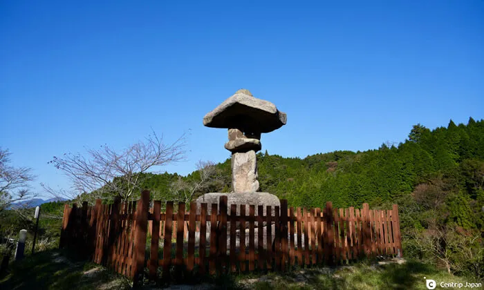 A standing light near the top of Suzuka Pass, which once illuminated the path at night.
It is approximately 6.6km from Seki-juku to Sakashita-juku, 3km from Sakashita-juku to the night lamp at the top of Suzuka Pass, and 6.8km from there to the next stop, Tsuchiyama-juku. The hike takes about 6 to 7 hours including breaks. There are few places to buy food and drink along the way. However, the barbecue restaurant near Suzuka Pass serves game and trout dishes, and there is a fishing pond where you can catch trout.
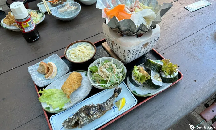 Trout dishes served at BBQ Suzuka Pass
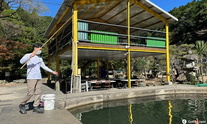 You can also have the fish you catch in the pond cooked for you
There are limited means of returning from Tsuchiyama-juku to Seki-juku, so if you must return to Seki-juku, you must return to Sakashita-juku from Suzuka Pass and take a community bus (fare ¥200) from the bus stop outside Sakashita Community Centre back to Seki-eki-mae.
If you choose to walk to Tsuchiyama-juku, you can take a bus from the bus stop Omi-Tsuchiyama at Tsuchiyama-juku to Kibugawa station on the JR Kusatsu line, which takes about 1 hour to Kyoto station via Kusatsu station.
Wrap-up
The Tokaido Highway, which connected Edo and Kyoto, the two largest cities in the Edo period, is an indispensable avenue for a deeper understanding of Japan. Along this highway, various local cultures developed, and townscapes unique to each region formed. Many of these spots are easily explored within a half-day to a full-day trip from Nagoya, so please visit them to experience the beauty of the other Samurai Trail.