
![]() |
Centrip Editorial Board
|
Centrip Editorial Board
Kumano Kodo Ise Route: Crossing the Magose Pass

The Kumano Kodo Ise Road is a World Heritage Site and part of the Kumano Kodo, a religious route that connects two of Japan's most sacred sites, the Kumano Sanzan and Ise Shrine.
The Magose Pass goes through Ise-ji and is one of the most popular hiking trails along the Kumano Kodo. Its well-preserved stone paths give the impression that this is a Kumano Kodo route. This article introduces the hike over the Magose Pass, stopping at two spectacular viewpoints, Tengukurayama and Binishiyama.
Recommended Hiking Trails in Magome Pass
From Michi-no-eki Miyama to the top of Magose Pass
For this itinerary, we parked our car at the parking lot of Michi-no-eki Miyama, crossed the Magose Pass on the Kumano Ancient Road, passed through downtown Owase, and then returned to the parking lot by local bus. It is a 10-minute walk from Michi-no-eki Miyama to the top of Magose Pass.
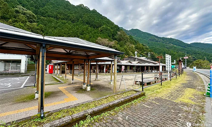 Start from the parking lot of Michi-no-eki Miyama
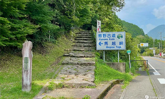 Entrance to the climb up to Magose Pass
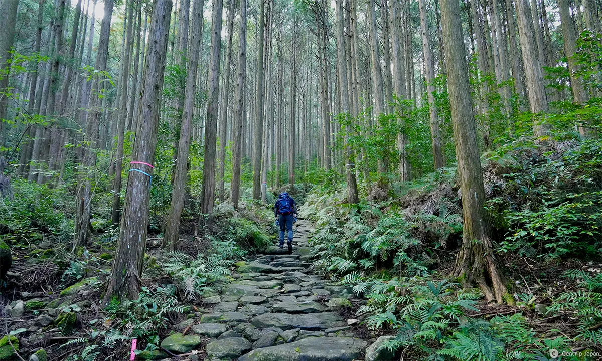
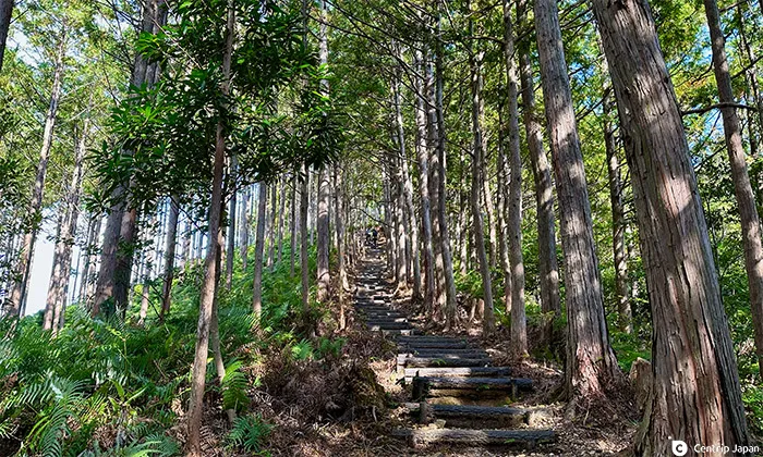
As you pass the sign for Magose Pass and step off the busy national highway onto the Kumano Kodo, the atmosphere changes immediately, creating the sensation of stepping through time to the Edo period. The ancient road is breathtaking, with moss-covered cobblestones paving the way amidst the thick cypress trees that stretch straight ahead.
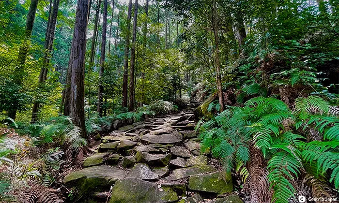
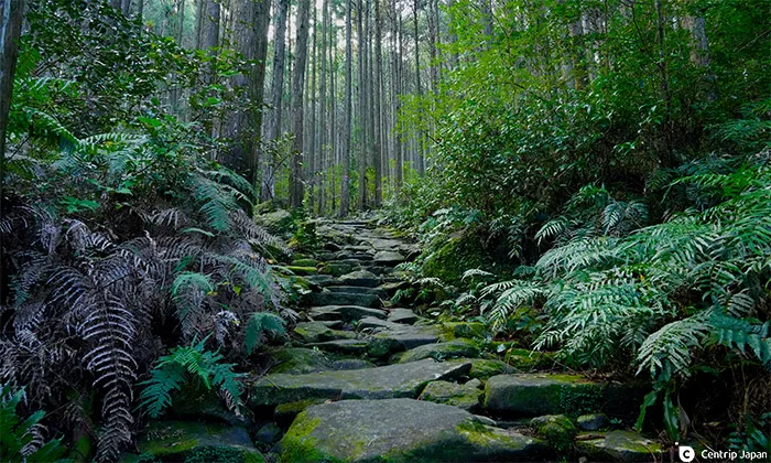 Stone pavement continues deep into the woods
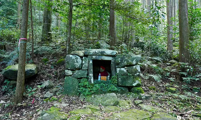 Night weeping Jizo watch over travelers to ensure their safety
The Kishu Clan maintained the stone pavement in this section during the Edo period. The paths fit the width of the Kishu Clan's baskets, approximately 2.7 meters wide, so it was broader than other roads of that time.
 Quietly walking along the cobblestones creates a sense of being in the Edo period
The cobblestone pavements were not just for decoration but were unique to the region. The design prevented heavy rainfall from washing out the road. When the newly constructed National Route 42 collapsed and was closed to traffic due to Typhoon No. 21 in 2004, the cobblestone pavements of the Magose Pass were not affected, and disaster relief volunteers could cross the pass on foot.
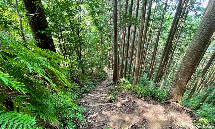
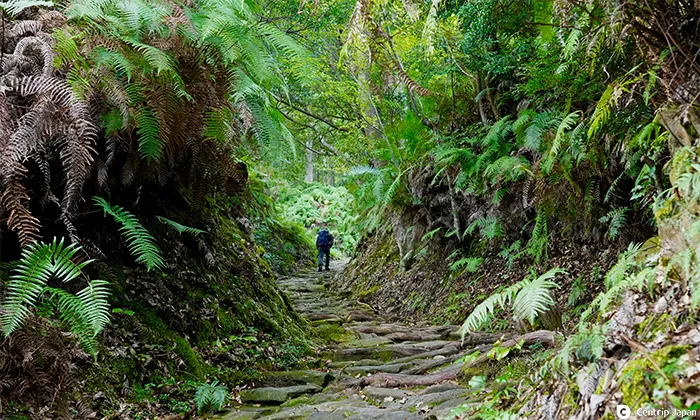 Follow the old road, surrounded by thick ferns
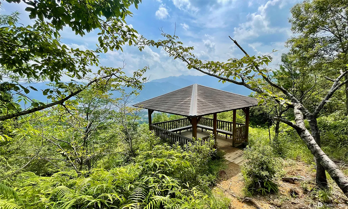
 A rest area with an open view
After 30 minutes of walking up the path, being careful of the slippery cobblestones, you will eventually come to an open area where you can see the surrounding mountains. Here, benches are placed for visitors to rest.
 The light becomes brighter as we approach the summit
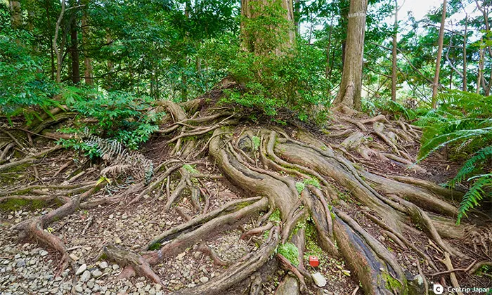 Huge cypress trees are growing roots
Another 20 minutes from the rest area to the top of Magose Pass at an altitude of 325 meters. The elevation of Michi-no-eki Miyama, today's starting point, is 17 meters above sea level, so you'll have climbed just over 300 meters by this point.
Unfortunately, the summit of Bakoshi Pass is forested, so there is not much of a view, but there are many benches where you can take a break and recharge your batteries.
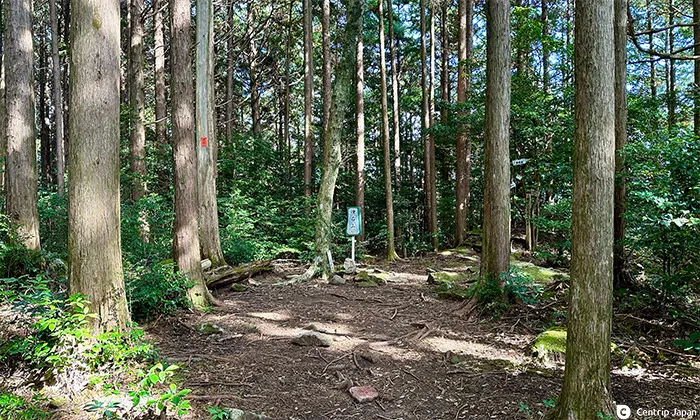
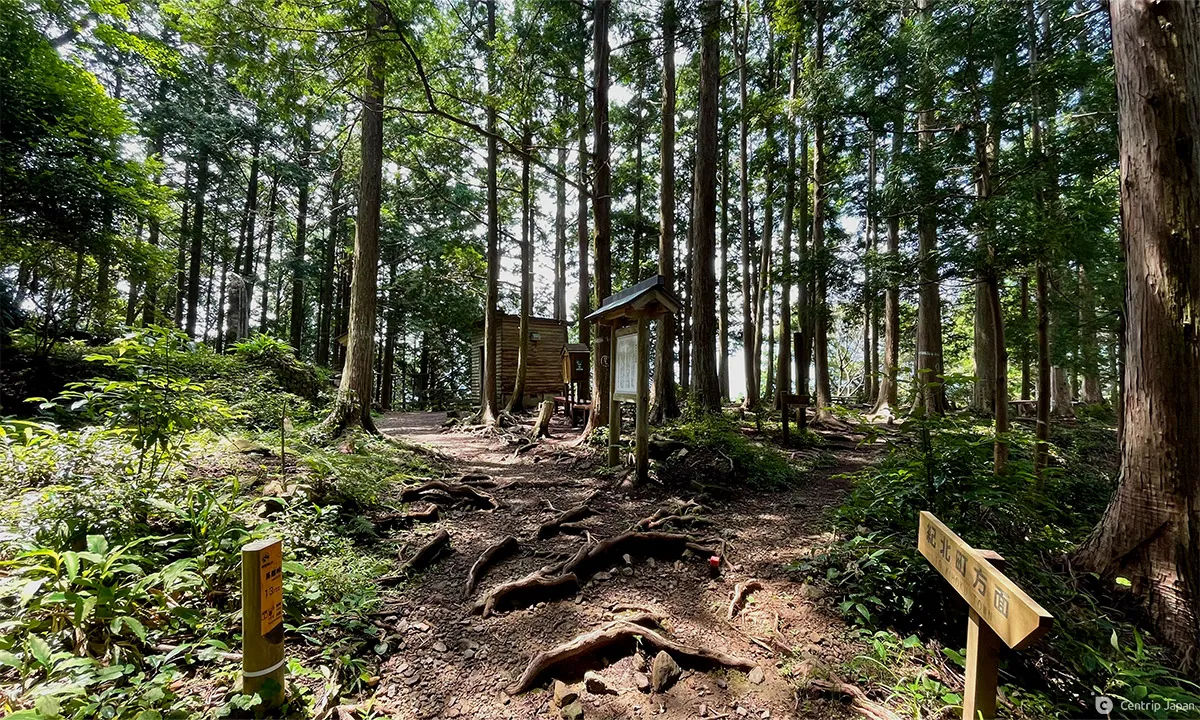 The sign "13/22" on the Magoshi Pass marks the top of the pass
Magose Pass to Mt. Tengurayama
At the top of the pass, there are three options. (1) Continue on the Kumano Kodo route and descend to downtown Owase, (2) go to Mt. Tengurayama on the left, or (3) go to Mt. Binishiyama on the right. Routes (2) and (3) leave the Kumano Kodo but offer pleasurable climbing and spectacular views. If you are physically fit, you should take this side trip.
 Magose Pass to Mt. Tengurayama
 Steep climbing continues
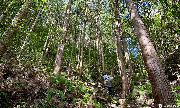
First, we head for the 522-meter-high Mt. Tengurayama on the left side of the mountain. The atmosphere changes from the cobblestone trail of the Magose Pass as we enter the Tengukurayama trail, crawling with tree roots. The information board says it takes about 30 minutes from Magose Pass, but the 200-meter difference in elevation makes it a strenuous hike.
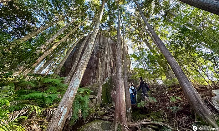 Looking up at the huge rock is astonishing!
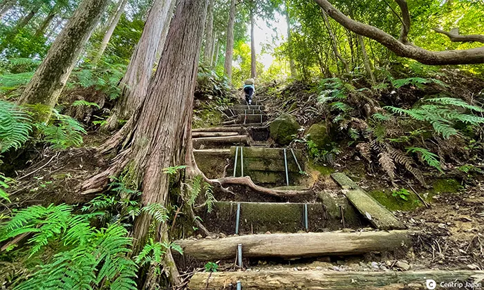
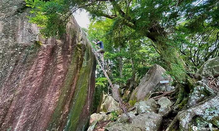 A solid metal ladder leans against the big rock
It is very steep as you climb, and soon a large rock will enter your line of sight. It is the summit of Tengurayama. If you turn back in the direction you came, you will find a metal ladder that allows you to climb up to the top of the rock.
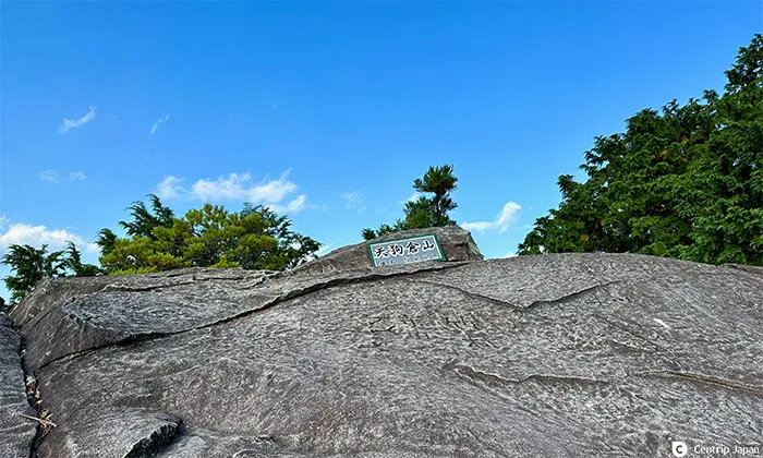 An unexpectedly large space on top of the rock
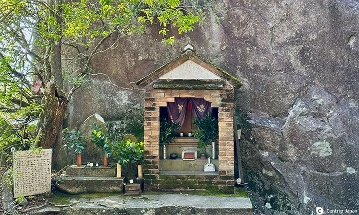 A shrine dedicated to En no Gyoja
At the bottom of the ladder is a shrine dedicated to En no Gyoja, the founder of Shugendo in Japan. Climbing the ladder, you will find an open space with enough room for about ten people to relax and a modest plaque. The trees in front of you will block your view, so to get a better look try the ledge below the big rock.
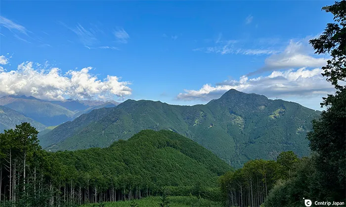
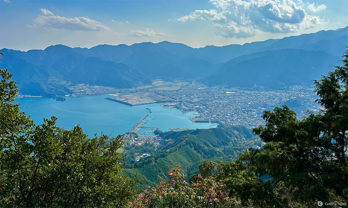 Owase city center and the Kumano-nada Sea seen from the summit of Mt. Tengurayama
Magome Pass to Mt. Binishiyama
From the summit of Mt. Tengurayama, we headed back to the Magose Pass and onwards to the other peak, Binishiyama. Binishiyama is about 600 meters above sea level (598.9 meters, to be exact). From the Magose Pass, you must go down and then ascend Mt. Binishiyama, making for a longer climb.
 A beautifully maintained trail
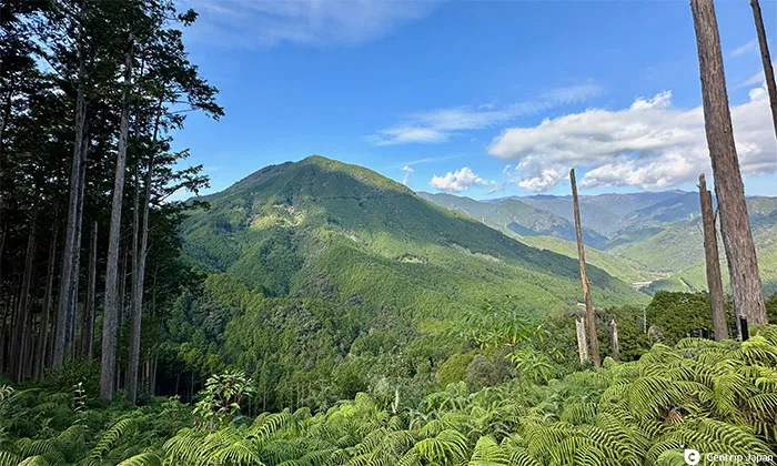 A panoramic view of Mt. Binishiyama
As you descend from the Magose Pass, you get a panoramic view of Mt. Binishiyama. From this point on, we climbed up a beautifully maintained stairway, and the walk was not difficult, but the length made it quite challenging.
 The slope gets steeper as you approach the summit
 Many trees crowd the summit
As you approach the summit, you will see several large rocks placed here. Go past them, and you are at the top of the mountain. The time it takes to reach the summit of Mt. Binishiyama from Magose Pass is about 2 hours for the ascent and about 1 hour for the return descent.
Only a modest plaque is at the summit of Mt. Binishiyama, but this is where the real fun begins. A few minutes further is the Elephant's Back, a spot with a spectacular view. From the Elephant's Back, you can see everything from Tengurayama, which we just climbed, to downtown Owase and the calm waters of the Sea of Kumano.
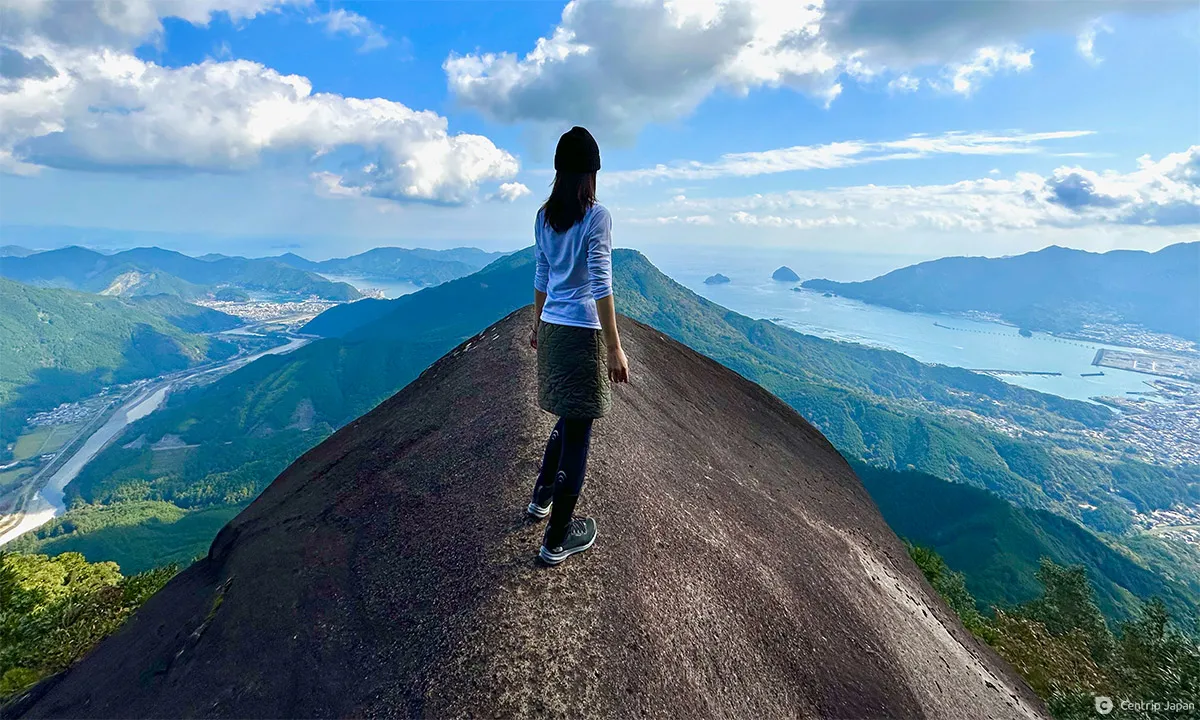 The Elephant's Back is a spectacular view perfect for social media
The Elephant's Back is a huge rock jutting out from the mountain that looks just like an elephant's back in color and shape. Of all the scenic places in Japan, there are few where you can get a view like this, let alone stand on the back of an elephant, to enjoy the breathtaking scenery. Take this chance to get some superb photos. (*If you are afraid of heights, you might feel like your feet are sinking.)
From Magose Pass to Owase City
When the excitement of seeing the spectacular view from the Elephant's Back, we descended Mt. Binishiyama and returned to Magose Pass for the third time. There are two options for the return route from here: one is to turn back to the Magose Pass that we climbed in the morning and return to Mt. Miiyama, and the other is to continue on the Kumano Kodo and descend to downtown Owase.
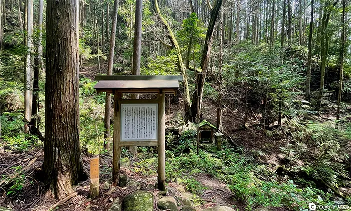 Sakura Jizo
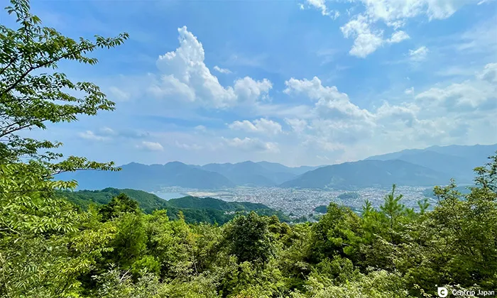 Owase City from the Magose Pass observatory
We continued on the Kumano Kodo, heading toward downtown Owase. Compared to the morning's ascent on the north side, the descent on the south is gentler, but be careful as water gushes out of the ground making the cobblestones wet and slippery in some sections. About 20 minutes downhill from the Magose Pass, there is an observatory overlooking the city of Owase, where you can rest.
 The viewpoint at Umaokoshi Pass, the finish is just around the corner
After passing the observation deck, you will soon arrive at Magose Park, the southern starting point for the climb up the Magose Pass. A stylish mountain lodge-style café, Yama-Korai, is near the park, but as of October 2022, the café is closed for business.
From in front of Prefectural Owase Office Building to Miyama Roadside Station
Take the Mie Kotsu bus from downtown Owase back to your car at Michi-no-eki Miyama.
It takes about 2 kilometers from Magose Park to the Owase Prefectural Office Building Bus Stop next to the Mie Prefectural Owase Office Building. If you miss your scheduled bus, you may have to wait for more than an hour, and there aren't many places to kill time. Please check the latest timetable of Mie Kotsu and plan your trip accordingly
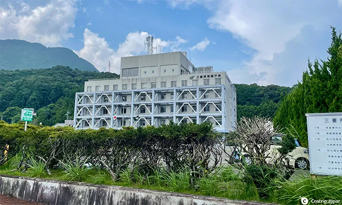 Mie Prefecture's Owase Town Hall
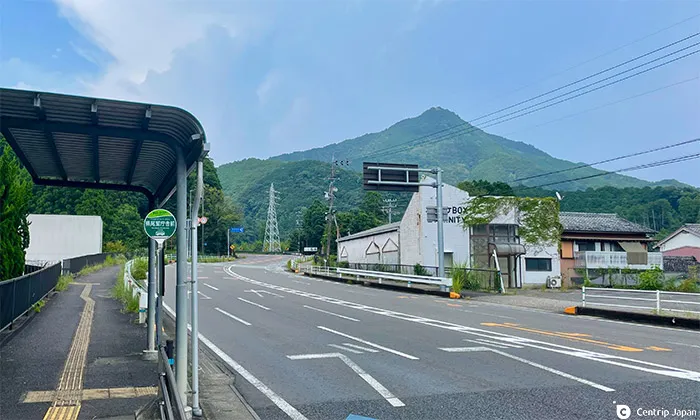 Mt. Tengurayama viewed from the bus stop
Take a bus bound for Kiinagashima Station, Shimakatsu, Matsusaka Station, or Matsusaka Chuobyo, and get off at the Washige bus stop one stop away. The fare is ¥320, and you can get off right in front of the entrance to the Magose Pass.
Approximate Time Required
Roadside Station Miyama →(10 min) Magose Pass Ascent →(50 min) Magose Pass Summit →(30 min) Tengurayama Summit →(20 min) Magose Pass Summit →(120 min) Mt. Binishiyama Summit, Elephant's Back →(60 min) Magose Pass Summit →(40 min) Magose Park →(30 min) Owase Prefectural Office bus stop →(10 min) Washige bus stop → Roadside Station Miyama
Wrap-up
If you are driving from Nagoya to Michi-no-eki Miyama, the base for hiking the Magose Pass, take the Higashi-Meihan Expressway, then the Ise Expressway, Kisei Expressway, and Kumano Owase Road, and exit at the Miyama IC. From the Miyama IC, it is a short drive to Michi no Eki Miyama, and the entire trip takes about 2 to 2 hours and 30 minutes.
The hiking trails of the Magose Pass described in this article will take a full day to complete, but we recommend that you take the time to fully enjoy the atmosphere of the World Heritage Kumano Kodo Trail and its spectacular natural scenery. There are no vending machines along the way, so bring plenty of water and good shoes (preferably hiking shoes) to avoid slipping on the trail.
Click here to get the latest information on Central Japan.Centrip Japan - Nagoya and Chubu Information